IMAGES TAKEN NEAR TO
Glenwood Way, CROYDON, CR0 7RT
Introduction
This page details the photographs taken nearby to Glenwood Way, CR0 7RT by members of the Geograph project.
The Geograph project started in 2005 with the aim of publishing, organising and preserving representative images for every square kilometre of Great Britain, Ireland and the Isle of Man.

There are currently over 7.5m images from over14,400 individuals and you can help contribute to the project by visiting https://www.geograph.org.uk
Image Map
Images are licensed for reuse under creativecommons.org/licenses/by-sa/2.0
Notes
- Clicking on the map will re-center to the selected point.
- The higher the marker number, the further away the image location is from the centre of the postcode.
Image Listing (75 Images Found)
Images are licensed for reuse under creativecommons.org/licenses/by-sa/2.0
Image
Details
Distance
1
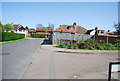
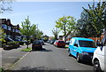
Gladeside, Croydon.
Viewed from Homer Road.
Image: © Alex McGregor
Taken: 11 Mar 2010
0.09 miles
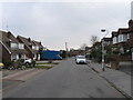
2
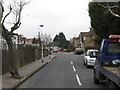
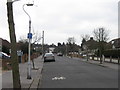
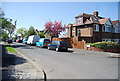
Fairhaven Avenue, Croydon.
Viewed from Gladeside.
Image: © Alex McGregor
Taken: 11 Mar 2010
0.09 miles
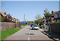
9
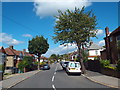
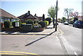
Gladeside, near Shirley
Gladeside passes through a residential area in South London's outer suburbs.
It forms part of National Cycle Network route 21
Image: © Malc McDonald
Taken: 21 Aug 2016
0.12 miles