IMAGES TAKEN NEAR TO
Water Lane, COLCHESTER, CO4 5QD
Introduction
This page details the photographs taken nearby to Water Lane, CO4 5QD by members of the Geograph project.
The Geograph project started in 2005 with the aim of publishing, organising and preserving representative images for every square kilometre of Great Britain, Ireland and the Isle of Man.

There are currently over 7.5m images from over14,400 individuals and you can help contribute to the project by visiting https://www.geograph.org.uk
Image Map
Images are licensed for reuse under creativecommons.org/licenses/by-sa/2.0
Notes
- Clicking on the map will re-center to the selected point.
- The higher the marker number, the further away the image location is from the centre of the postcode.
Image Listing (14 Images Found)
Images are licensed for reuse under creativecommons.org/licenses/by-sa/2.0
Image
Details
Distance
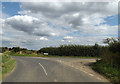
1
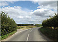
Dedham Road junction
Near Alderton's Cottages
Image: © Geographer
Taken: 16 Aug 2014
0.08 miles
2
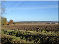
Ploughed field west of Langham
Docura's Farm is across the fields in the right.
Image: © Robin Webster
Taken: 19 Nov 2017
0.12 miles
3
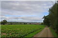
The Essex Way east of Plumb's Farm
In the Dedham Vale AONB, looking towards the Stour valley ahead.
Image: © Tim Heaton
Taken: 15 Oct 2020
0.14 miles
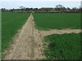
4
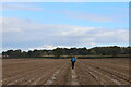
Essex Way crosses another Ploughed Field near Langham
Boot imprints in the field indicate the correct path to take across.
Image: © Chris Heaton
Taken: 15 Oct 2020
0.16 miles
5
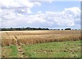
Farmland near Boxted
The path through the ripening crop is the Essex Way footpath.
Image: © David Kemp
Taken: 7 Jul 2007
0.17 miles
6
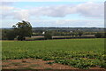
View from Plumb's Farm
Looking over the Stour Valley from the Essex Way
Image: © Chris Heaton
Taken: 15 Oct 2020
0.17 miles
7
Footpath Junction
Footpath junction near to Langham, Essex.
Image: © Keith Evans
Taken: 10 Apr 2016
0.19 miles
8
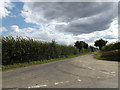
Dedham Road, Langham
At the junction with Greyhound Hill
Image: © Geographer
Taken: 16 Aug 2014
0.23 miles
9
Greyhound Hill, Langham
At the junction with Dedham Road
Image: © Geographer
Taken: 16 Aug 2014
0.23 miles
10
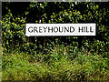
Greyhound Hill sign
On Greyhound Hill at the junction with Dedham Road
Image: © Geographer
Taken: 16 Aug 2014
0.24 miles