IMAGES TAKEN NEAR TO
Sporehams Lane, CHELMSFORD, CM3 4AJ
Introduction
This page details the photographs taken nearby to Sporehams Lane, CM3 4AJ by members of the Geograph project.
The Geograph project started in 2005 with the aim of publishing, organising and preserving representative images for every square kilometre of Great Britain, Ireland and the Isle of Man.

There are currently over 7.5m images from over14,400 individuals and you can help contribute to the project by visiting https://www.geograph.org.uk
Image Map
Images are licensed for reuse under creativecommons.org/licenses/by-sa/2.0
Notes
- Clicking on the map will re-center to the selected point.
- The higher the marker number, the further away the image location is from the centre of the postcode.
Image Listing (14 Images Found)
Images are licensed for reuse under creativecommons.org/licenses/by-sa/2.0
Image
Details
Distance
1
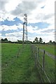
Towards Sporhams Lane
This is the Image Sporhams Lane is just beyond the hedge.
Image: © Glyn Baker
Taken: 20 May 2011
0.06 miles
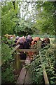
3
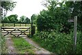
Towards Butts Green
This footpath runs from Sporhams Lane to Butts Green Lane
Image: © Glyn Baker
Taken: 20 May 2011
0.06 miles
5
Horses Grazing at Levetts Farm
Photograph taken from Woodhill Common Road.
Image: © Malcolm Reid
Taken: 1 Feb 2007
0.18 miles
6
Bovine Welcoming Committee
As soon as I made an appearance on the stile there was a mini stampede across the field. I expect it was getting near feeding time. A few none to subtle mentions of Dewhursts seemed to clear the way!
Image: © Glyn Baker
Taken: 20 May 2011
0.20 miles
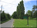
7
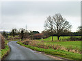
Sporhams Lane
This lane is so plated, and serves Sporhams Farm, yet the OS map calls it Sporehams Lane.
Image: © Robin Webster
Taken: 8 Dec 2012
0.20 miles
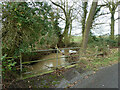
8
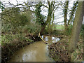
Tributary of Sandon Brook
At the Woodhill Common Road bridge. A lot of water is coming down, partly caused by snow melt. Looking downstream.
Image: © Robin Webster
Taken: 8 Dec 2012
0.20 miles
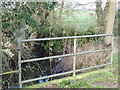
9
Tributary of Sandon Brook
At the Woodhill Common Road bridge. A lot of water is coming down, partly caused by snow melt. Looking downstream.
Image: © Robin Webster
Taken: 8 Dec 2012
0.21 miles
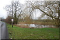
10
Sandon Brook
On Woodhill Common Road there is a small bridge where it crosses Sandon Brook.
Image: © Malcolm Reid
Taken: 1 Feb 2007
0.21 miles