IMAGES TAKEN NEAR TO
Foremans, Roxwell Road, CHELMSFORD, CM1 2GQ
Introduction
This page details the photographs taken nearby to Foremans, Roxwell Road, CM1 2GQ by members of the Geograph project.
The Geograph project started in 2005 with the aim of publishing, organising and preserving representative images for every square kilometre of Great Britain, Ireland and the Isle of Man.

There are currently over 7.5m images from over14,400 individuals and you can help contribute to the project by visiting https://www.geograph.org.uk
Image Map (Loading...)


Getting Data...Please wait
Leaflet Map data © OpenStreetMap
Images are licensed for reuse under creativecommons.org/licenses/by-sa/2.0
Notes
- Clicking on the map will re-center to the selected point.
- The higher the marker number, the further away the image location is from the centre of the postcode.
Image Listing (20 Images Found)
Images are licensed for reuse under creativecommons.org/licenses/by-sa/2.0
Image
Details
Distance
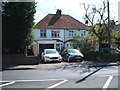
4
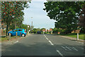
Roxwell Road (A1060), Chelmsford
Looking east.
Image: © JThomas
Taken: 5 Aug 2017
0.07 miles
5
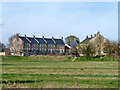
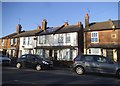
Houses, Windley Tye, Chelmsford
Newish in an old style.
Image: © Robin Webster
Taken: 25 Mar 2012
0.08 miles
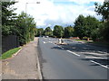
7
Chignall Road, Chelmsford
Heading north with Chignall Corner bus stop ahead.
Image: © Robin Webster
Taken: 15 Sep 2011
0.17 miles
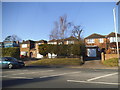
8
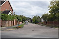
Roxwell Avenue
A suburban road on the western side of Chelmsford, taken from Roxwell Road.
Image: © Trevor Harris
Taken: 20 Sep 2018
0.19 miles
9
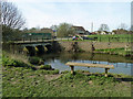
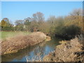
Site of Beach's Mill
The bridge is over the former mill race on the River Can. It latterly processed leather. In 1901 the owners turned to brickmaking, with a works on the far bank and clay pits downstream on the near bank, connected by a narrow gauge railway which ran over the bridge. Over twenty years ago the track was visible on the bridge, set in concrete. Today the surface is tarmac - perhaps the rails are still there underneath. The rest of the mill substructure upstream of the footbridge is used for modern sluices.
Image: © Robin Webster
Taken: 25 Mar 2012
0.20 miles
10
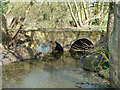
Bridge over former course of River Can
This acted as a bypass for the former Beach's Mill. It is now filled in behind the viewpoint, all the river goes over the modern weir at the mill site.
Image: © Robin Webster
Taken: 25 Mar 2012
0.21 miles