
IMAGES TAKEN NEAR TO
Sefton Road, WIRRAL, CH62 5AT
Introduction
This page details the photographs taken nearby to Sefton Road, CH62 5AT by members of the Geograph project.
The Geograph project started in 2005 with the aim of publishing, organising and preserving representative images for every square kilometre of Great Britain, Ireland and the Isle of Man.

There are currently over 7.5m images from over14,400 individuals and you can help contribute to the project by visiting https://www.geograph.org.uk
Image Map
Images are licensed for reuse under creativecommons.org/licenses/by-sa/2.0
Notes
- Clicking on the map will re-center to the selected point.
- The higher the marker number, the further away the image location is from the centre of the postcode.
Image Listing (10 Images Found)
Images are licensed for reuse under creativecommons.org/licenses/by-sa/2.0
Image
Details
Distance
1
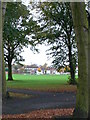
New Ferry Park
A green oasis in the middle of New Ferry.
Image: © Eirian Evans
Taken: 29 Oct 2007
0.07 miles
2
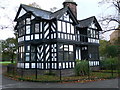
Park Lodge, New Chester Road, New Ferry
A grade II listed building, this former lodge is now a restaurant.
Image: © Eirian Evans
Taken: 29 Oct 2007
0.14 miles
3
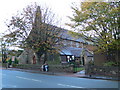
St Mark's Church, New Ferry
The Church of St Mark the Evangelist (C of E) on New Chester Road. It was founded in 1866 as a chapel to Bebington, and became a parish church in 1888 serving part of Lower Bebington.
Image: © Eirian Evans
Taken: 29 Oct 2007
0.15 miles
5
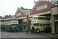
Birkenhead Corporation Motor Omnibus Garage
This was the Corporation's secondary garage at New Ferry, built in the 1930s. Sadly it has now been demolished and replaced by commercial development.
In this view buses of the former Birkenhead Corporation and Wallasey Corporation bus fleets can be seen, by now operated by Merseyside PTE. The blue bus is in the PTE's Wirral division livery, representing the blue of Birkenhead with the cream of Wallasey (neither accurate continuations!). The cream bus is a former Wallasey bus and was on a special tour saying farewell after some 20 years of service. It was repainted specially and has been preserved. It is shown here as if working on the old service 10 which was operated jointly by the two undertakings, running between New Ferry and New Brighton. A feature of both Birkenhead and Wallasey buses was the very large and clear destination display.
This is one of a series of views featuring buses in the 60s, 70s, and 80s. http://www.geograph.org.uk/search.php?i=2114547&displayclass=slide
Image: © Alan Murray-Rust
Taken: 28 Jan 1973
0.20 miles
6
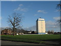
Highrise Flats on New Chester Road, New Ferry
Looking across Knowsley Road playing fields to the flats on New Chester Road, New Ferry.
Image: © Sue Adair
Taken: 17 Jan 2007
0.24 miles
7
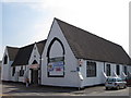
Old School, New Ferry
The old school in School Lane, now used as an ex civil defence services social club.
For history of New Ferry see:-
http://www.newferryonline.org.uk/
Image: © Sue Adair
Taken: 17 Jun 2010
0.25 miles
8
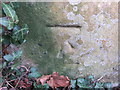
Weathered bench mark in Highfield South
This weathered bench mark is on a gatepost set back in a semi-circle from Highfield South. Image Image
Image: © John S Turner
Taken: 21 Mar 2016
0.25 miles
9
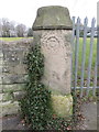
Weathered gatepost in Highfield South
This weathered gatepost is set back from Highfield South. The 'smiley face' at the top of the post seems to have been caused by the weathering of the original design. There is an Ordnance Survey bench mark at the foot of the post - Image
Image: © John S Turner
Taken: 21 Mar 2016
0.25 miles
10
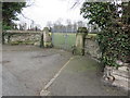
Gateway in Highfield South
This locked gateway provides access to the school playing fields from Highfield South. There is an Ordnance Survey bench mark at the base of the far gatepost - Image
Image: © John S Turner
Taken: 21 Mar 2016
0.25 miles