
IMAGES TAKEN NEAR TO
Littlemore Close, WIRRAL, CH49 4GS
Introduction
This page details the photographs taken nearby to Littlemore Close, CH49 4GS by members of the Geograph project.
The Geograph project started in 2005 with the aim of publishing, organising and preserving representative images for every square kilometre of Great Britain, Ireland and the Isle of Man.

There are currently over 7.5m images from over14,400 individuals and you can help contribute to the project by visiting https://www.geograph.org.uk
Image Map
Images are licensed for reuse under creativecommons.org/licenses/by-sa/2.0
Notes
- Clicking on the map will re-center to the selected point.
- The higher the marker number, the further away the image location is from the centre of the postcode.
Image Listing (13 Images Found)
Images are licensed for reuse under creativecommons.org/licenses/by-sa/2.0
Image
Details
Distance
1

Saughall Massie Road junction and bridge
The junction of the B5192 Saughall Massie Road, with the old road leading from the Saughall pub. Visible down the old road is Saughall Massie bridge, which crosses the River Fender. The bridge is believed to be the first ever built by Thomas Brassey. http://en.wikipedia.org/wiki/Thomas_Brassey
Image: © El Pollock
Taken: 12 Jun 2012
0.12 miles
2
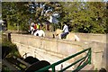
Saughall Massie Bridge
This was built in 1829. At this time, shipwrecking was still practised at Leasowe, and this road enabled constables to cross the marshes to apprehend the wreckers. The bridge is significant in that it was the first bridge to be built by Thomas Brassey (1805-1870). He was a civil engineer in the same league as the Stephensons, Telford and Brunel and his company built a substantial portion of the world's railways. See http://en.wikipedia.org/wiki/Thomas_Brassey
Image: © Peter Craine
Taken: 21 Oct 2007
0.13 miles
3
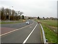
Saughall Massie By-pass
A relatively new stretch of road built in early 2004 that by-passed the village of Saughall Massie. The electronic board below the 'upcoming curve' sign flashes whenever somebody is going over the 30mph speed limit.
Image: © David Quinn
Taken: 15 Mar 2008
0.13 miles
4

Saughall Massie Road new bridge
A tractor, towing a load of hay, crosses the new bridge on the B5192 Saughall Massie Road.
Image: © El Pollock
Taken: 12 Jun 2012
0.14 miles
5
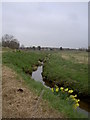
Arrowe Brook
Taken just south of Saughall Massie. Arrowe Brook is a short river starting near Irby, passing through Arrowe Country Park before ending at a confluence with The Birket.
Image: © David Quinn
Taken: 15 Mar 2008
0.16 miles
6
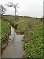
Confluence between Arrowe Brook and Greasby Brook.
Arrowe Brook is on the left and Greasby Brook on the right.
Image: © David Quinn
Taken: 15 Mar 2008
0.17 miles
7
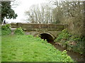
Saughall Massie Bridge
Saughall Massie bridge was the first bridge built by Thomas Brassey in 1829. It was built as part of a scheme to drain water from this part of the Wirral, to help the building of roads. The new roads also allowed access to a previously lawless area, and the police constables soon ended the 'Wrecker' culture that had grown here, where boats were lured into the marsh land by false lights and then raided.
Arrowe Brook flows under the bridge.
Image: © David Quinn
Taken: 15 Mar 2008
0.17 miles
8
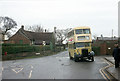
At the Saughall Massie Hotel
When this picture was taken, Wallasey Corporation's buses had already passed into the hands of the Merseyside PTE. This bus was the last survivor of a type which had been giving service for around 20 years, and is seen on a private tour at the Saughall Massie terminus of one of the Corporation's routes. Even today the village character of this location is largely retained.
This is one of a series of views featuring buses in the 60s, 70s, and 80s. http://www.geograph.org.uk/search.php?i=2114547&displayclass=slide
Image: © Alan Murray-Rust
Taken: 28 Jan 1973
0.22 miles
9
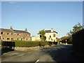
Saughall Massie Village
Sandstone cottages and public house at junction of Saughall Massie Road with West Kirby Road, recently by-passed.
Image: © Sue Adair
Taken: 13 Nov 2005
0.22 miles
10
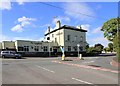
The Saughall
A public house at the junction of Saughall Road and West Kirby Road.
The pub food was quite good; we ate here a couple of times. Free wi-fi, but only in the bar.
Image: © David P Howard
Taken: 23 Jul 2012
0.23 miles