Saughall Massie Bridge
Introduction
The photograph on this page of Saughall Massie Bridge by David Quinn as part of the Geograph project.
The Geograph project started in 2005 with the aim of publishing, organising and preserving representative images for every square kilometre of Great Britain, Ireland and the Isle of Man.

There are currently over 7.5m images from over 14,400 individuals and you can help contribute to the project by visiting https://www.geograph.org.uk
Saughall Massie Bridge
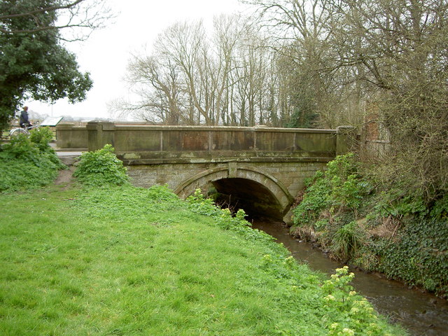
Image: © David Quinn Taken: 15 Mar 2008
Saughall Massie bridge was the first bridge built by Thomas Brassey in 1829. It was built as part of a scheme to drain water from this part of the Wirral, to help the building of roads. The new roads also allowed access to a previously lawless area, and the police constables soon ended the 'Wrecker' culture that had grown here, where boats were lured into the marsh land by false lights and then raided. Arrowe Brook flows under the bridge.
Images are licensed for reuse under creativecommons.org/licenses/by-sa/2.0
Image Location
Latitude
53.388861
Longitude
-3.122857