IMAGES TAKEN NEAR TO
Heathbank Avenue, WALLASEY, CH44 3AS
Introduction
This page details the photographs taken nearby to Heathbank Avenue, CH44 3AS by members of the Geograph project.
The Geograph project started in 2005 with the aim of publishing, organising and preserving representative images for every square kilometre of Great Britain, Ireland and the Isle of Man.

There are currently over 7.5m images from over14,400 individuals and you can help contribute to the project by visiting https://www.geograph.org.uk
Image Map
Images are licensed for reuse under creativecommons.org/licenses/by-sa/2.0
Notes
- Clicking on the map will re-center to the selected point.
- The higher the marker number, the further away the image location is from the centre of the postcode.
Image Listing (10 Images Found)
Images are licensed for reuse under creativecommons.org/licenses/by-sa/2.0
Image
Details
Distance
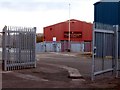
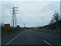
2
Ding Dong
Grid substation alongside Kingsway Tunnel Approach.
Image: © J Scott
Taken: 12 Nov 2010
0.08 miles
3
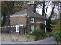
Sandstone Cottage
Cottage opposite Weatherhead School, Breck Road (B5145), Wallasey.
Image: © J Scott
Taken: 12 Nov 2010
0.08 miles
4
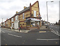
The corner shop
This shop is on the corner of Station Road and Mill Lane. Quite near is the entrance to the Mersey Tunnel and New Brighton docks.
Image: © Nigel Freeman
Taken: 17 Oct 2004
0.10 miles
5
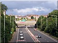
Mill Lane Bridge, Kingsway Tunnel Approach, Poulton
The view from Breck Road Bridge. Kingsway Tunnel Approach is the dual carriageway. Mill Lane is on the bridge which crosses over. This was originally the site of Liscard & Poulton railway station, on the branch line towards Seacombe.
Image: © El Pollock
Taken: 21 Jul 2009
0.12 miles
6
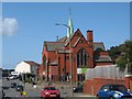
St Luke's Church Poulton
St Luke's was built at the junction of Mill Lane and Breck Lane in 1907 as the district church for the townships of Poulton cum Seacombe and Wallasey. In 1941, during an air raid, the church was hit by a bomb causing damage to the steeple and roof.
Image: © Sue Adair
Taken: 17 Aug 2019
0.13 miles
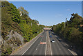
7
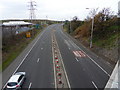
Slow Approach
Kingsway Tunnel Approach going West.
Image: © J Scott
Taken: 12 Nov 2010
0.14 miles
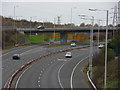
8
Kingsway Tunnel Approach near Bidston Moss
Image: © Colin Pyle
Taken: 4 Apr 2011
0.16 miles
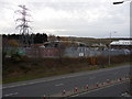
9
Over The Top
Kingsway Tunnel Approach goes beneath the Docks Link Road at Bidston Moss.
Image: © J Scott
Taken: 12 Nov 2010
0.18 miles