
IMAGES TAKEN NEAR TO
Boundary Road, PRENTON, CH43 7PF
Introduction
This page details the photographs taken nearby to Boundary Road, CH43 7PF by members of the Geograph project.
The Geograph project started in 2005 with the aim of publishing, organising and preserving representative images for every square kilometre of Great Britain, Ireland and the Isle of Man.

There are currently over 7.5m images from over14,400 individuals and you can help contribute to the project by visiting https://www.geograph.org.uk
Image Map
Images are licensed for reuse under creativecommons.org/licenses/by-sa/2.0
Notes
- Clicking on the map will re-center to the selected point.
- The higher the marker number, the further away the image location is from the centre of the postcode.
Image Listing (35 Images Found)
Images are licensed for reuse under creativecommons.org/licenses/by-sa/2.0
Image
Details
Distance
1

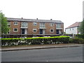
House
House at the junction of Upton Road and Boundary Road.
Image: © Peter McDermott
Taken: 25 May 2017
0.07 miles
2

Lodge house on Upton and Boundary Roads crossroads
This lodge is adjacent a covered reservoir
Image: © Raymond Knapman
Taken: 30 Aug 2012
0.07 miles
3
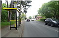
Bus stop and shelter on Upton Road (A5027)
Looking north east.
Image: © JThomas
Taken: 25 May 2019
0.07 miles
5
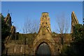
Flaybrick Cemetery Chapels
The cemetery on Boundary Road was laid out by the Birkenhead Improvement Commissioners in 1864. The two chapels (Anglican and Nonconformist) sharing a tall central spire (now sadly truncated) were designed by Lucy & Littler, closed in 1975 and are now in a sorry state. For a glimpse of the spire in its former glory see Alan Murray-Rust's photograph Image
Image: © Tiger
Taken: 26 Dec 2008
0.11 miles
6
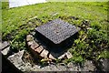
Part of water distribution system
On Bidston Road, outside Flaybrick Reservoir
Image: © Fractal Angel
Taken: 16 Aug 2007
0.12 miles
7

On Bidston Hill ? Boxing Day 1968 ? 2
View from King George's Way looking towards Flaybrick Cemetery. At this date the chapels were still in use and the fine spire intact. Today the spire has been truncated and the chapels are ruinous, although Listed Grade II.
Image: © Alan Murray-Rust
Taken: 26 Dec 1968
0.12 miles
8
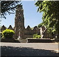
Derelict church in Flaybrick Memorial Garden
Image: © Ian Greig
Taken: 26 May 2017
0.12 miles
9
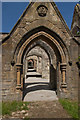
Ruined church in Flaybrick Memorial Garden
It was last in use in 1975
Image: © Ian Greig
Taken: 26 May 2017
0.12 miles
10
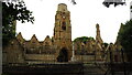
Flaybrick Memorial Gardens & ruinous chapels
Image: © Colin Park
Taken: 9 Jul 2021
0.13 miles