Flaybrick Cemetery Chapels
Introduction
The photograph on this page of Flaybrick Cemetery Chapels by Tiger as part of the Geograph project.
The Geograph project started in 2005 with the aim of publishing, organising and preserving representative images for every square kilometre of Great Britain, Ireland and the Isle of Man.

There are currently over 7.5m images from over 14,400 individuals and you can help contribute to the project by visiting https://www.geograph.org.uk
Flaybrick Cemetery Chapels
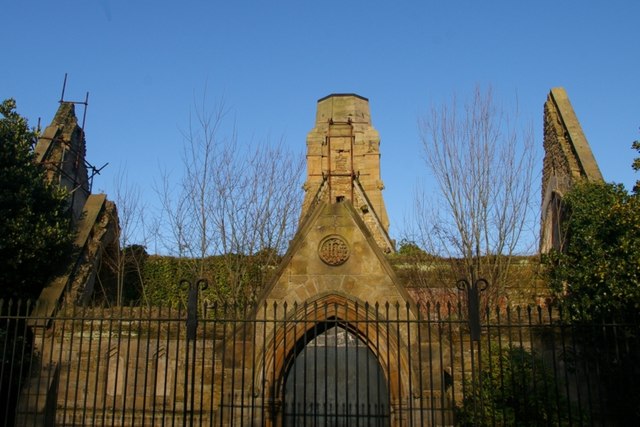
Image: © Tiger Taken: 26 Dec 2008
The cemetery on Boundary Road was laid out by the Birkenhead Improvement Commissioners in 1864. The two chapels (Anglican and Nonconformist) sharing a tall central spire (now sadly truncated) were designed by Lucy & Littler, closed in 1975 and are now in a sorry state. For a glimpse of the spire in its former glory see Alan Murray-Rust's photograph Image
Images are licensed for reuse under creativecommons.org/licenses/by-sa/2.0
Image Location
Latitude
53.39649
Longitude
-3.065307