
IMAGES TAKEN NEAR TO
Buccleuch Street, BIRKENHEAD, CH41 8HX
Introduction
This page details the photographs taken nearby to Buccleuch Street, CH41 8HX by members of the Geograph project.
The Geograph project started in 2005 with the aim of publishing, organising and preserving representative images for every square kilometre of Great Britain, Ireland and the Isle of Man.

There are currently over 7.5m images from over14,400 individuals and you can help contribute to the project by visiting https://www.geograph.org.uk
Image Map
Images are licensed for reuse under creativecommons.org/licenses/by-sa/2.0
Notes
- Clicking on the map will re-center to the selected point.
- The higher the marker number, the further away the image location is from the centre of the postcode.
Image Listing (68 Images Found)
Images are licensed for reuse under creativecommons.org/licenses/by-sa/2.0
Image
Details
Distance
2
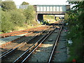
From Birkenhead North station platform
Looking halfway to Birkenhead Park station. Underneath, nearest, Ilchester Road, Buccleuch Street &, furthest, Lincoln Street girder road bridges. Formerly known as 'bomb alley' to train drivers, due to the nature of having to travel underneath the bridges, in one of the roughest parts of Birkenhead, before the River Street houses were demolished. The redbrick tunnel archway, barely visible in the distance, goes beneath Corporation Road.
Image: © El Pollock
Taken: 5 Sep 2004
0.10 miles
3
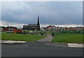
St James' Church, Birkenhead
As seen from Birkenhead North railway station.
Image: © Eirian Evans
Taken: 22 Jul 2011
0.13 miles
4

Birkenhead North Station
The view from the Ilchester Road overbridge, looking down the line towards West Kirby and New Brighton. In the 49 years since Ben Brooksbank's historic photo http://www.geograph.org.uk/photo/1802063 the through line on the right has been removed along with the semaphore signals, telegraph poles and canopy to the footbridge. Perhaps the most noticeable change between the two photos (taken in the same month) is the encroachment of trees and shrubs on both banks of the cutting. All the houses to the right have been demolished and those in the distance have been replaced by the Bidston Moss recycling centre.
Image: © Tiger
Taken: 9 May 2010
0.13 miles
5
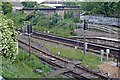
Signals, Birkenhead North railway station
Viewed from the opposite side of the rarely-used line to platform 1, though otherwise the same as Image
Image: © El Pollock
Taken: 7 Jun 2014
0.14 miles
7
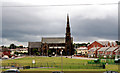
Birkenhead North: Church
Looking south from the forecourt of Birkenhead North Station, this church, which lies unfortunately just outside the same gridsquare, is a prominent landmark.
Image: © Dr Neil Clifton
Taken: 7 Jul 2010
0.14 miles
8
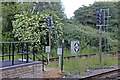
Signals, Birkenhead North railway station
Signals ML566 and ML568 are at the eastern end of the island platform.
Image: © El Pollock
Taken: 7 Jun 2014
0.14 miles
9
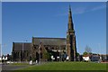
St James Church, Birkenhead
St James Church (on the church notice board it is described thus, with no apostrophe) is one of the great slum churches of Birkenhead, familiarly known as Jimmy's or "the Holy Doughnut", reflecting its former position on a traffic island at the junction of Laird Street and Hoylake Road. The architect C.E. Lang designed it in 1845 to minister to the workers in his nearby dockers' cottages, then at the very edge of the built-up area adjoining Bidston Moss. But work stalled, and a contemporary journal records that for many years the incomplete shell was occupied by poultry and even a wild goat. Walter Scott completed the building in 1858. This is the southern elevation from Ilchester Road.
Image: © Tiger
Taken: 9 May 2010
0.14 miles
10
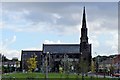
St. James' Church, Birkenhead
Viewed from Birkenhead North station footbridge.
Image: © El Pollock
Taken: 7 Jun 2014
0.14 miles