
IMAGES TAKEN NEAR TO
Grange Road East, BIRKENHEAD, CH41 5FE
Introduction
This page details the photographs taken nearby to Grange Road East, CH41 5FE by members of the Geograph project.
The Geograph project started in 2005 with the aim of publishing, organising and preserving representative images for every square kilometre of Great Britain, Ireland and the Isle of Man.

There are currently over 7.5m images from over14,400 individuals and you can help contribute to the project by visiting https://www.geograph.org.uk
Image Map
Images are licensed for reuse under creativecommons.org/licenses/by-sa/2.0
Notes
- Clicking on the map will re-center to the selected point.
- The higher the marker number, the further away the image location is from the centre of the postcode.
Image Listing (119 Images Found)
Images are licensed for reuse under creativecommons.org/licenses/by-sa/2.0
Image
Details
Distance
1
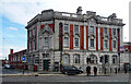
Former post office, Argyle Street, Birkenhead
A very fine example of Walter Pott's work for the Office of Works. Built 1905-06. Grade II listed.
It has been converted to offices but was possibly not occupied at the time.
Image: © Stephen Richards
Taken: 20 Aug 2014
0.03 miles
2
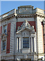
Former GPO building
Note the fine Royal Mail Edward VII monogram in the top panel.
Image: © Alan Murray-Rust
Taken: 5 Oct 2008
0.03 miles
3
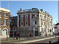
Former GPO, Argyle Street
Early 20th Century classicism. Now converted to offices, but note the fine pair of double pillar boxes still remaining.
Image: © Alan Murray-Rust
Taken: 5 Oct 2008
0.03 miles
4
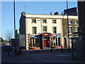
Old Post Office Hotel
A fine early Victorian public house, not too heavily rebuilt, on Argyle Street.
Image: © Alan Murray-Rust
Taken: 5 Oct 2008
0.05 miles
5
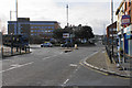
Roundabout on Argyle Street
This lies between the historic heart of the town and the newer shopping centres.
Image: © Bill Boaden
Taken: 22 Feb 2020
0.07 miles
6
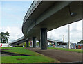
Flyover, Borough Road, Birkenhead
Carrying traffic towards central Birkenhead (left) or Chester/Mersey Tunnel (right).
Image: © Stephen Richards
Taken: 20 Aug 2014
0.07 miles
7
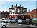
Fireman's Arms, Oliver Street East, Birkenhead
Pub, mostly surrounded by car parks.
The flags must have been in aid of the World Cup, which had finished in July.
Image: © Stephen Richards
Taken: 20 Aug 2014
0.07 miles
8
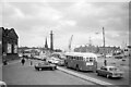
Queueing for the Mersey Tunnel, King's Square, Birkenhead ? 1966
The area is now a mass of flyovers, but then it was something of a free for all.
Visible landmarks include the monumental pylon marking the entrance, at the base of which can be seen some of the original toll booths https://www.geograph.org.uk/photo/1454533 . To its left is the spire of St Mary's Priory Church, and to the right a number of cranes at the Cammell Laird shipyards. Right at the left is just a corner of the large Birkenhead Market, which had a reputation as being one of the best in the north west of England.
The single deck bus in the foreground is a stranger in town, belonging to Stockport Corporation, and would have been on a private charter trip.
Image: © Alan Murray-Rust
Taken: 2 Jul 1967
0.09 miles
9

Flyover outside Birkenhead Central station
Image: © Raymond Knapman
Taken: 22 Mar 2012
0.09 miles
10
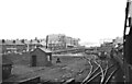
Heading for the docks, Birkenhead ? 1966
The Wirral and Mersey Special about to enter the tunnels and cuttings through the centre of the town. The sidings on the left with the weighbridge originally served the corporation gas works. Note the capstan alongside which was used with ropes to move wagons around, rather than using a locomotive.
The large building which looks like a cinema is the Shaftesbury Boys Club building, opened in 1936. The club http://www.shaftes.org.uk/index.aspx is still (2020) going strong, although having moved to a new site.
Image: © Alan Murray-Rust
Taken: 22 Oct 1966
0.10 miles