IMAGES TAKEN NEAR TO
Hockenhull Lane, CHESTER, CH3 8LE
Introduction
This page details the photographs taken nearby to Hockenhull Lane, CH3 8LE by members of the Geograph project.
The Geograph project started in 2005 with the aim of publishing, organising and preserving representative images for every square kilometre of Great Britain, Ireland and the Isle of Man.

There are currently over 7.5m images from over14,400 individuals and you can help contribute to the project by visiting https://www.geograph.org.uk
Image Map
Images are licensed for reuse under creativecommons.org/licenses/by-sa/2.0
Notes
- Clicking on the map will re-center to the selected point.
- The higher the marker number, the further away the image location is from the centre of the postcode.
Image Listing (9 Images Found)
Images are licensed for reuse under creativecommons.org/licenses/by-sa/2.0
Image
Details
Distance
3
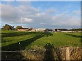
Farmland beside Baker Way
A gap in the hedge with a minute fence; Hockenhull Hall in the distance
Image: © David Smith
Taken: 20 Oct 2011
0.09 miles
5
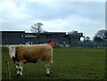
Hockenhull Hatchery, Hockenhull
View from bridleway Hockenhull 1 (part of the Baker Way) on bearing of 70 deg, distance about 80m. Two facets of the Cheshire farming scene in this tiny rural parish near Tarvin. The curious heifer stands in front of the hatchery, which belongs to British United Turkeys and is run as part of the turkey farm at nearby Hockenhull Hall Image
Image: © Mike Harris
Taken: 22 Feb 2006
0.14 miles
6
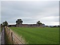
Hatchery for turkeys
According to WTP, this windowless building is the hatchery for the nearby turkey farm.
Image: © David Smith
Taken: 20 Oct 2011
0.14 miles
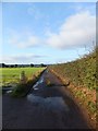
7
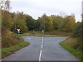
Hockenhull Lane crossing A51
The lane continues as a footpath on the opposite side of the road, then broadens to become a surfaced road in the village of Tarvin
Image: © David Smith
Taken: 20 Oct 2011
0.19 miles
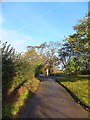
8
Hockenhull Lane
In the village, the lane is a surfaced road. This stops at the community wood, where it becomes a bridleway, crossing a signed cycleway along the A51, and continues as a surfaced road to the south of the main road. Old maps show the lane without interruption.
Image: © David Smith
Taken: 20 Oct 2011
0.20 miles
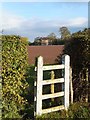
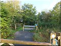
9
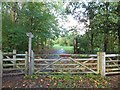
Tarvin Community Wood
The community woodland runs alongside the A51 to the south-west of the village. The board has details of activities in the wood.
Image: © David Smith
Taken: 20 Oct 2011
0.20 miles