
IMAGES TAKEN NEAR TO
Halkyn Road, CHESTER, CH2 3QE
Introduction
This page details the photographs taken nearby to Halkyn Road, CH2 3QE by members of the Geograph project.
The Geograph project started in 2005 with the aim of publishing, organising and preserving representative images for every square kilometre of Great Britain, Ireland and the Isle of Man.

There are currently over 7.5m images from over14,400 individuals and you can help contribute to the project by visiting https://www.geograph.org.uk
Image Map
Images are licensed for reuse under creativecommons.org/licenses/by-sa/2.0
Notes
- Clicking on the map will re-center to the selected point.
- The higher the marker number, the further away the image location is from the centre of the postcode.
Image Listing (254 Images Found)
Images are licensed for reuse under creativecommons.org/licenses/by-sa/2.0
Image
Details
Distance
1
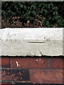
Bench mark on #10 Gresford Avenue, Hoole
This Ordnance Survey bench mark is actually in Ermine Road, on the side wall of #10 Gresford Avenue. See also Image
Image: © John S Turner
Taken: 10 Oct 2017
0.05 miles
2
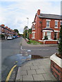
Ermine Road/Gresford Avenue junction
Looking along Ermine Road where it crosses Gresford Avenue. There is an Ordnance Survey bench mark on the white parapet on the right, which is actually the side wall of #10 Gresford Avenue - Image
Image: © John S Turner
Taken: 10 Oct 2017
0.06 miles
3
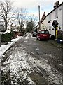
Ashby Place, Hoole, Chester
The cobbled street of Ashby Place near Flookersbrook. Flookersbrook has been cut off from Hoole Road which is now the main route into Chester and retains a quiet almost village atmosphere.
Image: © Jeff Buck
Taken: 22 Jan 2013
0.07 miles
4
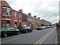
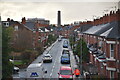
Ermine Road
Links Hoole Road with Brook Lane.
Image: © Dennis Turner
Taken: 14 Aug 2005
0.07 miles
6
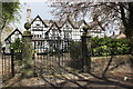
Flookersbrook Hall, Hoole, Chester
The original Flookersbrook Hall was destroyed during the siege of Chester (February 1645 to January 1646).
Image: © Jeff Buck
Taken: 30 Apr 2016
0.08 miles
7
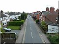
Ermine Road, Flookersbrook, seen from Chester Millennium Greenway
Image: © David Smith
Taken: 26 Apr 2024
0.09 miles
8
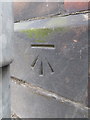
Bench mark in Ermine Road, Hoole
This Ordnance Survey bench mark is on the wall of a shop in Ermine Road, but it is hidden behind a modern lamppost. See also Image
Image: © John S Turner
Taken: 10 Oct 2017
0.10 miles
9
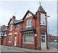
Back-street barber...
...at the junction of South Avenue and Ermine Road.
Image: © Bill Harrison
Taken: 30 Jun 2013
0.10 miles
10
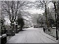
Flookersbrook, Chester
Flookersbrook stands on the line of an ancient road which stretched from the fortress at Deva to Warrington and beyond. Flookersbrook has been cut off from Hoole Road which is now the main route into Chester and retains a quiet almost village atmosphere.
Image: © Jeff Buck
Taken: 21 Jan 2013
0.10 miles