
IMAGES TAKEN NEAR TO
Abbots Drive, CHESTER, CH2 1AT
Introduction
This page details the photographs taken nearby to Abbots Drive, CH2 1AT by members of the Geograph project.
The Geograph project started in 2005 with the aim of publishing, organising and preserving representative images for every square kilometre of Great Britain, Ireland and the Isle of Man.

There are currently over 7.5m images from over14,400 individuals and you can help contribute to the project by visiting https://www.geograph.org.uk
Image Map
Images are licensed for reuse under creativecommons.org/licenses/by-sa/2.0
Notes
- Clicking on the map will re-center to the selected point.
- The higher the marker number, the further away the image location is from the centre of the postcode.
Image Listing (97 Images Found)
Images are licensed for reuse under creativecommons.org/licenses/by-sa/2.0
Image
Details
Distance
1
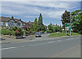
Abbot's Drive
Small crescent of houses off Liverpool Road.
Image: © Dennis Turner
Taken: 8 Jun 2008
0.03 miles
2
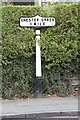
Old Milepost by the A5116, Liverpool Road, Chester
Cast iron post by the A5116, in parish of Chester (Chester District), Liverpool Road; by No. 62, 30m South of junction with Ormonde Road, back to low stone wall in privet hedge, on East side of road. Chester Cross iron plate and post, erected by the County Council in the 19th century.
Inscription reads:-
CHESTER CROSS
1 MILE
Maker:-
R T SMITH WHITCHURCH (SALOP)
Grade II listed.
List Entry Number: 1375901 https://historicengland.org.uk/listing/the-list/list-entry/1375901
Milestone Society National ID: CH_CHBH01
Image: © A Rosevear
Taken: 1 Jun 2004
0.05 miles
3
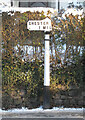
Old Milepost by the A5116, Liverpool Road, Chester
Cast iron post by the A5116, in parish of CHESTER (CHESTER District), Liverpool Road; by No. 62, 30m South of junction with Ormonde Road, back to low stone wall in privet hedge, on East side of road. Chester Cross iron plate and post, erected by the County Council in the 19th century. Top broken but subsequently replaced before November 2010.
Inscription reads:-
CHESTER (CROSS)
1 MIL(E)
Maker:-
R T Smith
Whitchurch
Grade II Listed.
List Entry Number: 1375901 https://historicengland.org.uk/listing/the-list/list-entry/1375901
Milestone Society National ID: CH_CHBH01.
Image: © John S Turner
Taken: 8 Jan 2010
0.05 miles

5
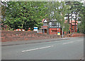
Pine Lodge
Academic unit of University of Liverpool.
Image: © Dennis Turner
Taken: 27 Aug 2005
0.08 miles
6
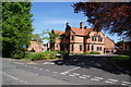
Gilwern Close, Chester
This has an anomalous appearance as a new housing development has been built round a Grade II listed building.
Image: © Bill Boaden
Taken: 1 May 2011
0.08 miles
7

Gilwern Close
Development nearing completion.
Image: © Dennis Turner
Taken: 5 Aug 2005
0.09 miles
8
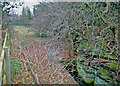
Former mill site
The site of a mill held by the Abbey of Chester which appears to have existed for 700 years until the Windmill was erected in Mill Lane. It became part of the garden of Bache Hall when the Hall was re-built after the Civil War.
Image: © Dennis Turner
Taken: 28 Feb 2009
0.09 miles
9
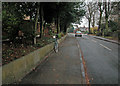
Abbot's Park
Main street in Abbot's Park.
Image: © Dennis Turner
Taken: 12 Dec 2002
0.09 miles
10
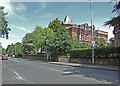
Liverpool Road
At the junction with Abbot's Park.
Image: © Dennis Turner
Taken: 8 Jun 2008
0.09 miles