IMAGES TAKEN NEAR TO
Darwin Road, CHESTER, CH1 5SU
Introduction
This page details the photographs taken nearby to Darwin Road, CH1 5SU by members of the Geograph project.
The Geograph project started in 2005 with the aim of publishing, organising and preserving representative images for every square kilometre of Great Britain, Ireland and the Isle of Man.

There are currently over 7.5m images from over14,400 individuals and you can help contribute to the project by visiting https://www.geograph.org.uk
Image Map
Images are licensed for reuse under creativecommons.org/licenses/by-sa/2.0
Notes
- Clicking on the map will re-center to the selected point.
- The higher the marker number, the further away the image location is from the centre of the postcode.
Image Listing (27 Images Found)
Images are licensed for reuse under creativecommons.org/licenses/by-sa/2.0
Image
Details
Distance
1
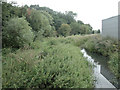
Drainage Channel
On the southern edge of the square, the area is marked on OS maps as Osier beds. Until the River Dee was canalised and the land was drained, it is believed that the river presently 1km south of here, reached this point. To the west of here, the land rises and on some maps the area is Blacon Point.
Image: © Dennis Turner
Taken: 16 Aug 2005
0.06 miles
2
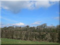
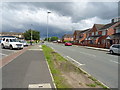
On the outskirts of Chester
Hedgerow alongside the Sealand Road.
Image: © Eirian Evans
Taken: 1 Mar 2012
0.08 miles
4
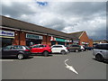
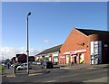
Post Office and shops on Western Avenue, Blacon
Image: © JThomas
Taken: 15 Jun 2019
0.11 miles
6
Blacon High School
Melbourne Road entrance to the High School at Blacon.
Image: © Josie Carman
Taken: 9 Mar 2006
0.12 miles
9
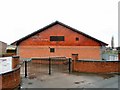
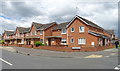
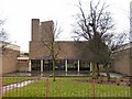
Modern Church Building
Church hall of the Jehovah's Witnesses at Blacon.
Image: © Josie Carman
Taken: 9 Mar 2006
0.18 miles
10
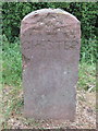
CHESTER 1998 boundary stone on the A548
This Chester City boundary stone sits alongside the A548 Sealand Road at its junction with Western Avenue, Blacon, and the top of the stone is badly damaged. The historic city/county/country boundary crosses the road at this point, and there is a City of Chester/Flintshire boundary stone on the opposite side of the road - Image
Image: © John S Turner
Taken: 17 May 2017
0.18 miles