CHESTER 1998 boundary stone on the A548
Introduction
The photograph on this page of CHESTER 1998 boundary stone on the A548 by John S Turner as part of the Geograph project.
The Geograph project started in 2005 with the aim of publishing, organising and preserving representative images for every square kilometre of Great Britain, Ireland and the Isle of Man.

There are currently over 7.5m images from over 14,400 individuals and you can help contribute to the project by visiting https://www.geograph.org.uk
CHESTER 1998 boundary stone on the A548
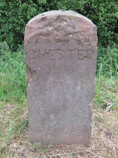
Image: © John S Turner Taken: 17 May 2017
This Chester City boundary stone sits alongside the A548 Sealand Road at its junction with Western Avenue, Blacon, and the top of the stone is badly damaged. The historic city/county/country boundary crosses the road at this point, and there is a City of Chester/Flintshire boundary stone on the opposite side of the road - Image
Images are licensed for reuse under creativecommons.org/licenses/by-sa/2.0
Image Location
Latitude
53.199341
Longitude
-2.939004