
IMAGES TAKEN NEAR TO
Brentwood Road, CHESTER, CH1 5DT
Introduction
This page details the photographs taken nearby to Brentwood Road, CH1 5DT by members of the Geograph project.
The Geograph project started in 2005 with the aim of publishing, organising and preserving representative images for every square kilometre of Great Britain, Ireland and the Isle of Man.

There are currently over 7.5m images from over14,400 individuals and you can help contribute to the project by visiting https://www.geograph.org.uk
Image Map
Images are licensed for reuse under creativecommons.org/licenses/by-sa/2.0
Notes
- Clicking on the map will re-center to the selected point.
- The higher the marker number, the further away the image location is from the centre of the postcode.
Image Listing (47 Images Found)
Images are licensed for reuse under creativecommons.org/licenses/by-sa/2.0
Image
Details
Distance
1
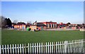
Colourful School, Blacon
I don't remember our school being as bright as this one. It was a drab sort of place.
Image: © Des Blenkinsopp
Taken: 2 Feb 2012
0.10 miles
2

Chester suburb
Houses in Western Avenue Blacon, a post war (WW2) suburb of the City of Chester
Image: © Dennis Turner
Taken: 12 Aug 2005
0.12 miles
3
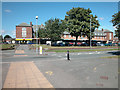
Blacon Shops
Parade of shops in a Chester suburb.
Image: © Dennis Turner
Taken: 12 Aug 2005
0.12 miles
4
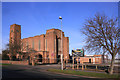
Saint Theresa's Church, Blacon
Catholic church and social club on Blacon Avenue.
Blacon is an unusual name. It was Blachehol in the Domesday Book. By 1260 this had morphed into Blackene, and subsequently into Blakenhill.
Image: © Des Blenkinsopp
Taken: 1 Feb 2012
0.12 miles
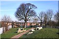
7
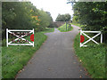
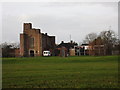
Welcome to Blacon
Looking along Blacon Greenway at the site of Blacon Old Station. The white fences seem to represent level crossing gates, although I don't believe there was ever a level crossing on this site. This track is part of the Sustrans National Cycle Network Route 5.
Image: © John S Turner
Taken: 16 Oct 2010
0.18 miles
8
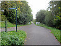
Blacon Greenway - towards Chester
Looking along the Blacon Greenway, which was once the trackbed for the Chester and Connah's Quay Railway. http://en.wikipedia.org/wiki/Chester_and_Connah's_Quay_Railway
This is part of Route 5 of the National Cycle Network with an access point to Saughall Road on the left.
Image: © John S Turner
Taken: 16 Oct 2010
0.19 miles
9
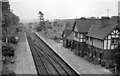
Blacon Station
View eastward, towards Chester (and Manchester); ex-GC Chester (Northgate) - Hawarden line, which was closed to passengers on 9/9/68, but the route by-passing Chester remained in use until the mid-1990s.
Image: © Ben Brooksbank
Taken: 21 May 1961
0.20 miles
10
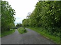
Access path to Chester Millennium Greenway
The path on the right at this fork leads to Western Avenue, Blacon
Image: © David Smith
Taken: 26 Apr 2024
0.20 miles