1
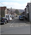
Coedcae Road, Abertridwr
Dead-end road on the east side of Aberfawr Road.
Image: © Jaggery
Taken: 28 Mar 2019
0.02 miles
2
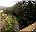
Nant Cwm-parc flows away from Aberfawr Road, Abertridwr
Viewed from this http://www.geograph.org.uk/photo/2934377 bridge. Nant is Welsh for stream.
Image: © Jaggery
Taken: 1 May 2012
0.03 miles
3
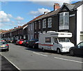
Coedcae Road, Abertridwr
Houses on the south side of Coedcae Road viewed from the corner of Aberfawr Road.
Image: © Jaggery
Taken: 1 May 2012
0.05 miles
4
Former railway route in Abertridwr
Looking east from this https://www.geograph.org.uk/photo/6118333 bridge. Passenger services in this area ended in 1964.
Image: © Jaggery
Taken: 28 Mar 2019
0.06 miles
5
Aber Cycleway at rear of Coedcae Road
Ramp access to Cycleway (NCR 475), on track bed of the defunct Aber Branch of the Rhymney Railway, from lane at rear of Coedcae Road.
Image: © M J Roscoe
Taken: 11 Apr 2018
0.06 miles
6
Aberfawr Road bungalow, Abertridwr
Originally, bungalow was used in English for a lightly-built house, with a veranda and one storey.
In current UK usage it is a convenient word for any one-storey dwelling.
Image: © Jaggery
Taken: 28 Mar 2019
0.07 miles
7
Peaceful Progress in Abertridwr
Text on the left side of the mural on Aberfawr Road bridge shows Peaceful Progress. https://www.geograph.org.uk/photo/6118360
The bridge carries the road over a former railway route. https://www.geograph.org.uk/photo/6118354
Image: © Jaggery
Taken: 28 Mar 2019
0.07 miles
8
Reminder of the Railway Age in Abertridwr
On the left here. https://www.geograph.org.uk/photo/6118358 Passenger services in this area ended in 1964.
Image: © Jaggery
Taken: 28 Mar 2019
0.07 miles
9
Aberfawr Terrace electricity substation, Abertridwr
Located alongside Aberfawr Road opposite the Aberfawr Terrace junction, the green cabinet is a Western Power Distribution electricity substation. Its identifier is ABERFAWR TERRACE S/S 54-2409. In March 2019, a notice on the cabinet states that the grassy area is part of the Aber Valley Wild Flower Habitat, an area of natural growth to provide a wildlife habitat. Do not mow this area or pick wild flowers.
Image: © Jaggery
Taken: 28 Mar 2019
0.07 miles
10
Aber Cycleway goes under Aberfawr Road
Cycleway (NCR 475) circumvents a grass mound (camera position) and watercourse channel to go under the bridge over the former railway track bed.
Image: © M J Roscoe
Taken: 11 Apr 2018
0.07 miles


