
IMAGES TAKEN NEAR TO
Commercial Street, HENGOED, CF82 8FG
Introduction
This page details the photographs taken nearby to Commercial Street, CF82 8FG by members of the Geograph project.
The Geograph project started in 2005 with the aim of publishing, organising and preserving representative images for every square kilometre of Great Britain, Ireland and the Isle of Man.

There are currently over 7.5m images from over14,400 individuals and you can help contribute to the project by visiting https://www.geograph.org.uk
Image Map
Images are licensed for reuse under creativecommons.org/licenses/by-sa/2.0
Notes
- Clicking on the map will re-center to the selected point.
- The higher the marker number, the further away the image location is from the centre of the postcode.
Image Listing (52 Images Found)
Images are licensed for reuse under creativecommons.org/licenses/by-sa/2.0
Image
Details
Distance
1
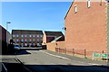
Roman Gate in Gelligaer
Cul-de-sac on the west side of Glyn-Gaer Road. The English/Welsh name sign on the right shows Roman Gate/Porth Rhuffeinig . This appears to be an error - the Welsh for Roman is Rhufeinig.
Image: © Jaggery
Taken: 14 Feb 2019
0.04 miles
2
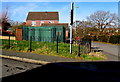
Wales & West Utilities gas installation on a Gelligaer corner
In a locked green enclosure on the corner of Commercial Street and Glyn-Gaer Road.
Image: © Jaggery
Taken: 14 Feb 2019
0.04 miles
3
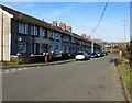
Long row of houses, Glyn-Gaer Road, Gelligaer
Extending for 80 metres from Oxford Street to Commercial Street.
Image: © Jaggery
Taken: 14 Feb 2019
0.05 miles
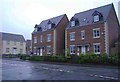
5
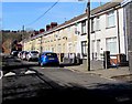
Oxford Street, Gelligaer
Looking west along Oxford Street from Glyn-Gaer Road towards Commercial Street.
The houses are opposite Glyn-Gaer Primary School.
Image: © Jaggery
Taken: 14 Feb 2019
0.05 miles
6
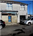
Derelict former shop, Oxford Street, Gelligaer
Located near Glyn-Gaer Primary School viewed in February 2019.
The postbox https://www.geograph.org.uk/photo/6059805 in the wall behind the grey car suggest that this
may once have been a post office.
Image: © Jaggery
Taken: 14 Feb 2019
0.06 miles
7
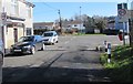
End of the 20 zone, Oxford Street, Gelligaer
The 20mph speed limit near Glyn-Gaer Primary School increases
to 30mph on the approach to the Glyn-Gaer Road junction.
Image: © Jaggery
Taken: 14 Feb 2019
0.06 miles
8
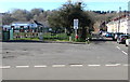
East side of Glyn-Gaer Primary School, Gelligaer
Viewed across Glyn-Gaer Road. Oxford Street is on the right.
Image: © Jaggery
Taken: 14 Feb 2019
0.06 miles
9
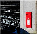
Queen Elizabeth II postbox in an Oxford Street wall, Gelligaer
Behind the car on the right here. https://www.geograph.org.uk/photo/6059803
Image: © Jaggery
Taken: 14 Feb 2019
0.06 miles
10
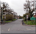
Glyn-Gaer Road, Glyn-Gaer
Viewed across the B4254. The Glyn-Gaer boundary sign is a few metres from this sign http://www.geograph.org.uk/photo/3453776 at the SW boundary of Penpedairheol. Both villages are part of Caerphilly County Borough.
Image: © Jaggery
Taken: 10 May 2013
0.06 miles