1
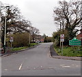
Gwaun-Fro houses, Penpedairheol
Gwaun-Fro is part of the Duffryn Park Estate at the SW edge of the village.
Image: © Jaggery
Taken: 10 May 2013
0.06 miles
2
Boulders at the edge of a football pitch near Gelligaer
Located in a recreation ground alongside the B4254 between Penpedairheol and Gelligaer.
Image: © Jaggery
Taken: 10 May 2013
0.06 miles
3
SW boundary of Penpedairheol
The boundary sign on the right is alongside the B4254 from Gelligaer.
The houses are part of the Duffryn Park Estate.
Penpedairheol is a village in Caerphilly County Borough.
A literal translation of the name is the top, head or end of four roads.
Image: © Jaggery
Taken: 10 May 2013
0.09 miles
4
KJM Autos, Penpedairheol
Viewed across the B4254. KJM Autos is a car sales, repairs, parts and accessories etc business.
Image: © Jaggery
Taken: 10 May 2013
0.10 miles
5
Footpath next to B4254, Penpedairheol
Public footpath towards Penpedairheol; a signpost indicates that this is a section of a Roman Trail.
Image: © M J Roscoe
Taken: 8 Apr 2017
0.10 miles
6
Pengam ACF hut near Gelligaer
Located in a locked compound at the edge of a recreation ground alongside the B4254 between Penpedairheol and Gelligaer. ACF is the acronym for Army Cadet Force.
Image: © Jaggery
Taken: 10 May 2013
0.11 miles
7
A view from the NE, Beechgrove Social Club, Penpedairheol
Located in The Square in the centre of the village.
http://www.geograph.org.uk/photo/3453682 to a view from the far side.
Image: © Jaggery
Taken: 10 May 2013
0.15 miles
8
Glyn-Gaer Road, Glyn-Gaer
Viewed across the B4254. The Glyn-Gaer boundary sign is a few metres from this sign http://www.geograph.org.uk/photo/3453776 at the SW boundary of Penpedairheol. Both villages are part of Caerphilly County Borough.
Image: © Jaggery
Taken: 10 May 2013
0.16 miles
9
Penpedairheol: post office and postbox № CF82 53
This office will close at the end of February 2008.
Image: © Chris Downer
Taken: 16 Feb 2008
0.16 miles
10
Rolls Avenue, Penpedairheol
Looking to the northeast along Rolls Avenue from Glyn-Gaer Road.
Image: © Jaggery
Taken: 14 Feb 2019
0.17 miles


