1
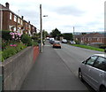
Park Road houses, Hengoed
Houses on the north side of the road are opposite railings, bushes and trees above the railway near Hengoed station.
Image: © Jaggery
Taken: 23 Aug 2019
0.01 miles
2
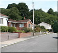
Side road on the north side of Park Road, Hengoed
Ascending towards Heol Dewi.
Image: © Jaggery
Taken: 23 Aug 2019
0.05 miles
3
Towards Heol Dewi, Hengoed
Road from the east side of Hengoed Road towards Heol Dewi.
Image: © Jaggery
Taken: 23 Aug 2019
0.06 miles
4
Hengoed Railway Station
Viewed from the site of the demolished Hengoed High Level station. http://www.geograph.org.uk/photo/2036236
Image: © Jaggery
Taken: 27 Aug 2010
0.09 miles
5
East along Heol Celyn, Hengoed
Viewed from near the corner of Hengoed Road. Heol Celyn leads to King's Hill out of shot ahead.
Image: © Jaggery
Taken: 23 Aug 2019
0.10 miles
6
Royal Mail drop box opposite The Bungalows, Hengoed
Alongside the road from Hengoed Road to Heol Dewi.
Image: © Jaggery
Taken: 23 Aug 2019
0.10 miles
7
Shades of green, Park Road, Hengoed
Green hedge, green trees, green telecoms cabinet.
Image: © Jaggery
Taken: 23 Aug 2019
0.10 miles
8
Neighbourhood Watch Area notice, Park Road, Hengoed
On the pole in the background here. https://www.geograph.org.uk/photo/6246136
Image: © Jaggery
Taken: 23 Aug 2019
0.10 miles
9
Eastern end of The Avenue, Ystrad Mynach
The Avenue ends at the edge of woodland. The western end is about 500 metres away, on the corner of Davies Street.
Image: © Jaggery
Taken: 27 Aug 2010
0.10 miles
10
The view from the SW edge of Hengoed railway station
Hengoed station is part of the Rhymney Line of the Valley Lines network. The next station is this direction is Ystrad Mynach.
The bridge carries National Cycle Network route 47, formerly the track of the line that went through now-demolished Hengoed High Level station and across a viaduct. http://www.geograph.org.uk/photo/2036662
Image: © Jaggery
Taken: 27 Aug 2010
0.10 miles


