
IMAGES TAKEN NEAR TO
Greenfield Street, BARGOED, CF81 9RH
Introduction
This page details the photographs taken nearby to Greenfield Street, CF81 9RH by members of the Geograph project.
The Geograph project started in 2005 with the aim of publishing, organising and preserving representative images for every square kilometre of Great Britain, Ireland and the Isle of Man.

There are currently over 7.5m images from over14,400 individuals and you can help contribute to the project by visiting https://www.geograph.org.uk
Image Map
Images are licensed for reuse under creativecommons.org/licenses/by-sa/2.0
Notes
- Clicking on the map will re-center to the selected point.
- The higher the marker number, the further away the image location is from the centre of the postcode.
Image Listing (159 Images Found)
Images are licensed for reuse under creativecommons.org/licenses/by-sa/2.0
Image
Details
Distance
1
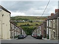
Greenfield Street, Pontlottyn
From the A469, this is the view down one of the steep streets of terraced houses that have been built on this side of the Rhymney Valley.
Across the valley at the right, Carn Y Tyla Terrace, Abertwssyg can be seen http://www.geograph.org.uk/photo/987915 .
Image: © Robin Drayton
Taken: 23 Aug 2008
0.01 miles
2
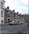
North side of Greenfield Street, Pontlottyn
Greenfield Street is one of several steep streets descending from the A469
towards flat ground on the west bank of the Rhymney River.
Image: © Jaggery
Taken: 19 Apr 2013
0.02 miles
3
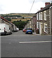
Down Greenfield Street, Pontlottyn
Greenfield Street descends from the A469 to Fairview Terrace.
Image: © Jaggery
Taken: 27 Jul 2018
0.03 miles
4
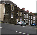
North side of Tynewydd Street, Pontlottyn
Stone houses alongside the descent from the A469 Southend Terrace to Fairview Terrace.
Image: © Jaggery
Taken: 27 Jul 2018
0.03 miles
5
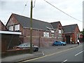
Elim Community Church, Pontlottyn
Occupying a former school building built in 1899.
Image: © Robin Drayton
Taken: 23 Aug 2008
0.04 miles
6
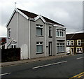
Grey detached house on a Pontlottyn corner
The A469 Waterloo Terrace side of the house on the corner of Greenfield Street.
The size and location of the house suggest that it may have once been a corner shop or other business premises.
Image: © Jaggery
Taken: 27 Jul 2018
0.04 miles
7
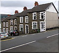
Tynewydd Street houses, Pontlottyn
Stone houses at the top end of Tynewydd Street viewed across the A469.
Image: © Jaggery
Taken: 27 Jul 2018
0.04 miles
8
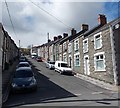
Greenfield Street, Pontlottyn
Greenfield Street is a 100-metre long residential street between Fairview Terrace on the camera side, and the A469 (Waterloo Terrace and Southend Terrace) at the far end.
Image: © Jaggery
Taken: 19 Apr 2013
0.04 miles
9
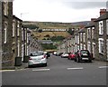
Down Tynewydd Street, Pontlottyn
Tynewydd Street descends from the A469 Southend Terrace to Fairview Terrace.
Image: © Jaggery
Taken: 27 Jul 2018
0.04 miles
10
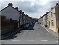
Tynewydd Street, Pontlottyn
Tynewydd Street is a 115 metre long residential street between Fairview Terrace
at the camera end and the A469 Southend Terrace ahead.
Image: © Jaggery
Taken: 19 Apr 2013
0.05 miles