1
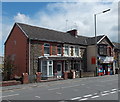
West side of Park Place, Gilfach
Stone houses on the west side of Park Place viewed from The Capel pub & hotel bus stop.
Image: © Jaggery
Taken: 1 May 2019
0.04 miles
2
Bargoed Fire Station
Bargoed Fire Station, William Street, Gilfach, Bargoed - one of the stations run by South Wales Fire & Rescue Service. When this picture was taken, the station was threatened with possible closure.
Image: © Kevin Hale
Taken: 4 Jun 2007
0.04 miles
3
Bargoed Fire Station, Gilfach
The fire station, though named Bargoed, is located in the adjoining village of Gilfach, set back from the corner of William Street. It is part of the South Wales Fire and Rescue Service.
This http://www.geograph.org.uk/photo/467177 is how the station looked in 2007.
Image: © Jaggery
Taken: 15 May 2013
0.04 miles
4
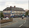
Capel, Gilfach
Large pub and bed & breakfast, located on Park Place, straddling the Gilfach/Bargoed boundary
Image: © Jaggery
Taken: 7 May 2010
0.05 miles
5
PC Mobility Services showroom, Gilfach
The premises are located between Park Place and William Street, near the fire station. http://www.geograph.org.uk/photo/3463055
PC Mobility Services specialise in the sale and repair of mobility equipment and mobility aids.
Image: © Jaggery
Taken: 15 May 2013
0.05 miles
6
Ordnance Survey Cut Mark
This OS cut mark can be found on the wall of No29 Hillside Park. It marks a point 211.290m above mean sea level.
Image: © Adrian Dust
Taken: 31 Aug 2019
0.05 miles
7
Northern boundary of Gilfach
The Gilfach boundary sign on the right is back-to-back with the boundary sign http://www.geograph.org.uk/photo/3463912 for Bargoed.
The Capel http://www.geograph.org.uk/photo/3463904 is on the left.
Image: © Jaggery
Taken: 15 May 2013
0.05 miles
8
Southern boundary of Bargoed
The road from the village of Gilfach reaches the town of Bargoed. The boundary sign is located between Cardiff Road on the left and Park Place on the right. The Welsh name for the town is Bargod. It is strange that the English name is Bargoed, using an oe formation rare in English. Perhaps the spelling arose because of the analogy of nearby Hengoed (meaning old wood).
Image: © Jaggery
Taken: 15 May 2013
0.06 miles
9
BT phonebox, Park Place, Gilfach
Located between a bus stop and The Capel. https://www.geograph.org.uk/photo/3463904
The Bargoed boundary sign is on the left.
Image: © Jaggery
Taken: 1 May 2019
0.06 miles
10
Park Place houses and shop, Gilfach
The shop is Valley News & Stores, 45 Park Place.
Image: © Jaggery
Taken: 15 May 2013
0.06 miles


