Southern boundary of Bargoed
Introduction
The photograph on this page of Southern boundary of Bargoed by Jaggery as part of the Geograph project.
The Geograph project started in 2005 with the aim of publishing, organising and preserving representative images for every square kilometre of Great Britain, Ireland and the Isle of Man.

There are currently over 7.5m images from over 14,400 individuals and you can help contribute to the project by visiting https://www.geograph.org.uk
Southern boundary of Bargoed
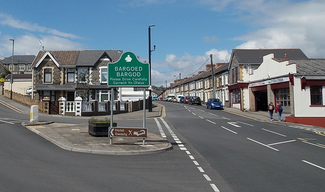
Image: © Jaggery Taken: 15 May 2013
The road from the village of Gilfach reaches the town of Bargoed. The boundary sign is located between Cardiff Road on the left and Park Place on the right. The Welsh name for the town is Bargod. It is strange that the English name is Bargoed, using an oe formation rare in English. Perhaps the spelling arose because of the analogy of nearby Hengoed (meaning old wood).
Images are licensed for reuse under creativecommons.org/licenses/by-sa/2.0
Image Location
Latitude
51.683498
Longitude
-3.229441