1
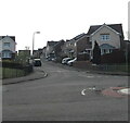
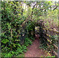
Blackthorn Court, Llanharry
Cul-de-sac on the east side of Addison Avenue.
Image: © Jaggery
Taken: 21 Apr 2021
0.04 miles
2
Blackthorn Court, Llanharry
Cul-de-sac and private road on the east side of Addison Avenue.
Image: © Jaggery
Taken: 21 Apr 2021
0.06 miles
3
East along the M4 motorway, Llanharry
Viewed from this https://www.geograph.org.uk/photo/6815427 bridge at the southern edge of Llanharry in Rhondda Cynon Taff County Borough.
Image: © Jaggery
Taken: 21 Apr 2021
0.06 miles
4
The M4 at Llanharry
Image: © John Lord
Taken: 19 Jan 2018
0.06 miles
5
East along a track in the south of Llanharry
The white arrow on a public footpath direction sign https://www.geograph.org.uk/photo/6815449 points this way.
Image: © Jaggery
Taken: 21 Apr 2021
0.09 miles
6
From 20 to 30, Llanharry
Near the SW edge of the village, the 20mph speed limit in force near schools increases to 30mph. In the background, the road crosses a bridge over the M4 motorway.
Image: © Jaggery
Taken: 21 Apr 2021
0.10 miles
7
Mini-roundabout, Addison Avenue, Llanharry
At the Blackthorn Court junction.
Image: © Jaggery
Taken: 21 Apr 2021
0.10 miles
8
Rhondda Cynon Taf : M4 Motorway
The M4 Motorway heading eastbound as it passes through the Rhondda Cynon Taf area.
Image: © Lewis Clarke
Taken: 11 Apr 2014
0.10 miles
9
Public footpath direction sign at the southern edge of Llanharry
The white arrow on the green sign points towards this track https://www.geograph.org.uk/photo/6815451 near the north side of the M4 motorway.
Image: © Jaggery
Taken: 21 Apr 2021
0.10 miles
10
Track at the edge of a field, Degar
The track is above the M4 motorway at the southern edge of Llanharry.
Image: © Jaggery
Taken: 21 Apr 2021
0.11 miles


