1
Trio Brasserie, Cowbridge
Located in eastern Cowbridge at the crossroads of Cardiff Road, Aberthin Road, Eastgate and St Athan Road. The Shorter Oxford English Dictionary defines brasserie as
"A (French) saloon selling beer and usually food; generally, an informal restaurant."
The second definition applies here.
Image: © Jaggery
Taken: 19 Jan 2012
0.05 miles
2
Edmondes Arms, Jack's Corner, Cowbridge
Pub on the corner of Cardiff Road and Aberthin Road. Both roads are the A4222 which makes a 90 degree turn here.
The name Jack’s Corner on the building recalls a dog that once lived here. The year on the pub name sign is 1899, but there is a reference to The Edmondes Arms Public House in an 1895 edition of a Kelly's Directory, so presumably the current building was built on the site of its predecessor. The Directory records that a Mrs Edmondes of High Street is a "principal landowner" in Cowbridge.
Image: © Jaggery
Taken: 19 Jan 2012
0.05 miles
3
Bench Mark, Cowbridge
This bench mark is in the bus shelter against the remaining bridge parapet of the long closed Cowbridge and Aberthaw railway.
It is shown on the 1909 OS map but appears to be from George V or VI's era. Perhaps it is a replacement for an earlier one. The recorded elevation on the map is 101.3ft
Image: © Guy Butler-Madden
Taken: 23 Feb 2012
0.09 miles
4
Ordnance Survey Cut Mark
This OS cut mark can be found on the north parapet of the old railway bridge on Cardiff Road. It marks a point 41.087m above mean sea level.
Image: © Adrian Dust
Taken: 19 Apr 2018
0.09 miles
5
Old Milestone by the A4222, Eastgate, Cowbridge
Stone post by the A4222, in parish of Cowbridge with Llanblethian (Vale of Glamorgan District), Eastgate, Cowbridge, at junction with Aberthin Road, set in angled wall.
Inscription indistinct.
Surveyed
Milestone Society National ID: GLA_CFBE12
Image: © Milestone Society
Taken: Unknown
0.09 miles
6
Tower, Cowbridge Fire Station
The training tower is in the northern corner of the fire station. http://www.geograph.org.uk/photo/2770973
Image: © Jaggery
Taken: 19 Jan 2012
0.12 miles
7
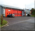
Cowbridge Fire Station
Located in Druids Green, Cowbridge, the station is part of the South Wales Fire and Rescue Service.
In addition to Cowbridge, the station covers the surrounding villages, such as Llanblethian, Colwinston, St Mary Church, Llandow, Aberthin and St Hilary, giving a residential population of c9000. Much of the c34 square miles covered by the station is farmland.
Image: © Jaggery
Taken: 19 Jan 2012
0.12 miles
8
Cowbridge Post Office
Post office and store on Eastgate.
Image: © Mike Faherty
Taken: 12 Jul 2016
0.12 miles
9
Ordnance Survey Flush Bracket (S1255)
This OS Flush Bracket can be found on the south face of the school. It marks a point 39.867m above mean sea level.
Image: © Adrian Dust
Taken: 9 Apr 2016
0.13 miles
10
Eastgate Mews, Cowbridge
House on the corner of Eastgate and Croft Terrace, viewed from Druids Green.
The red phonebox on the left, dating from c1950, was Grade II listed in November 1992.
Image: © Jaggery
Taken: 19 Jan 2012
0.13 miles


