Bench Mark, Cowbridge
Introduction
The photograph on this page of Bench Mark, Cowbridge by Guy Butler-Madden as part of the Geograph project.
The Geograph project started in 2005 with the aim of publishing, organising and preserving representative images for every square kilometre of Great Britain, Ireland and the Isle of Man.

There are currently over 7.5m images from over 14,400 individuals and you can help contribute to the project by visiting https://www.geograph.org.uk
Bench Mark, Cowbridge
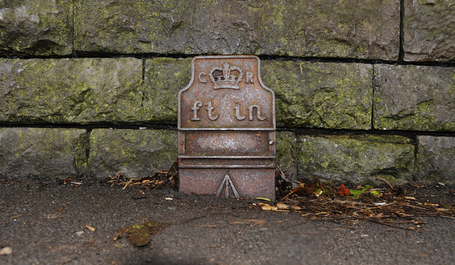
Image: © Guy Butler-Madden Taken: 23 Feb 2012
This bench mark is in the bus shelter against the remaining bridge parapet of the long closed Cowbridge and Aberthaw railway. It is shown on the 1909 OS map but appears to be from George V or VI's era. Perhaps it is a replacement for an earlier one. The recorded elevation on the map is 101.3ft
Images are licensed for reuse under creativecommons.org/licenses/by-sa/2.0
Image Location
Latitude
51.458902
Longitude
-3.44089