1
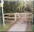
Whitcliffe Drive
Modern housing on prime clifftop position at Cosmeston, south Penarth. There are sweeping views across the Severn to Somerset.
Image: © Colin Smith
Taken: 7 Jun 2008
0.04 miles
2
Southern end of Whitcliffe Drive, Cosmeston
The main course of Whitcliffe Drive is north-south near the edge of cliffs facing the Bristol Channel (or Mouth of the Severn). There are three short west-facing arms near its southern end. This is the southernmost arm.
Image: © Jaggery
Taken: 24 Nov 2010
0.04 miles
3
Wales Coast Path, Cosmeston
After passing through woodland on the edge of the cliff, the path emerges to the southern Penarth suburbs.
Image: © Stephen McKay
Taken: 26 Jun 2018
0.07 miles
4
Whitcliffe Drive, Cosmeston
The path here is a rather suburban stretch of the Wales Coast Path, passing some of the most desirable properties in Wales on the other side of the street. The effect of the lack of recent rain is becoming obvious in the grass verge.
Image: © Stephen McKay
Taken: 26 Jun 2018
0.07 miles
5
Coastal erosion
The significance of this image lies in its location, equidistant between the cliff edge and housing on Whitcliffe Drive, Penarth - both less than 20m away on either side. The crack lines follow the fissures in the limestone cliff and are widening with each passing season. It is only a matter of time …
Image: © Alan Hughes
Taken: 8 Sep 2022
0.07 miles
6
Wales Coast Path between Lower Penarth and Lavernock Point
To the left, the hedge protects you from the cliff edge and a drop of about 25m to the rocks below.
Image: © Eirian Evans
Taken: 22 Jun 2021
0.07 miles
7
End of the footpath, Cosmeston, Penarth
A cliff top footpath http://www.geograph.org.uk/photo/2192841 ends at the gate. The sign on the left warns that the track ahead is near an unprotected cliff edge. The track leads to Lavernock Point, http://www.geograph.org.uk/photo/64941 about 1500 metres away.
Image: © Jaggery
Taken: 24 Nov 2010
0.07 miles
8
Cycle path near Penarth
On the route of the former Cadoxton to Penarth railway line.
Image: © Gareth James
Taken: 9 Jun 2010
0.09 miles
9
Geological fault
Some sort of displacement has occurred here but I don’t know the geological explanation. Help, anybody?
Image: © Alan Hughes
Taken: 8 Sep 2022
0.09 miles
10
Fault line in Penarth cliffs
The bands of coloured mudstone clearly show the vertical displacement by about 5 metres on the left.
Image: © Alan Hughes
Taken: 8 Sep 2022
0.09 miles


