1
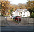
Sharp bend in Beach Road, Penarth
Adjacent to The Kymin, http://www.geograph.org.uk/photo/2173695 there is a sharp bend in Beach Road on its descent to the Esplanade.
Image: © Jaggery
Taken: 24 Nov 2010
0.03 miles
2
The Kymin, Penarth
Mid-Victorian (c1870) building set in several acres of grounds on the north side of Beach Road. Originally a private residence, the building and grounds are now owned by Penarth Town Council. Various local groups and organisations use the premises. One room is used for Quaker meetings. Local clubs meeting at the Kymin include chess, scrabble and petanque (boules).
Image: © Jaggery
Taken: 24 Nov 2010
0.03 miles
3
Steps from Beach Road, Penarth
Steps, part of the Wales Coast Path, next to The Kymin (right).
Image: © M J Roscoe
Taken: 30 Aug 2017
0.04 miles
4
Penarth Swimming Baths
Built in the 1880’s the public baths served the community and visitors for approximately a century. For a while they were converted into a pub, The Inn at the Deep End, before finally being converted into flats.
https://glamarchives.wordpress.com/2018/01/31/penarth-baths/
Image: © Alan Hughes
Taken: 6 Jan 2023
0.04 miles
5
Sea wall at Penarth
Image: © Roger Davies
Taken: 15 Jun 2011
0.04 miles
6
OVO e-bike charging station, Penarth
Situated on The Esplanade by Penarth Pier.
A hired e-bike may be returned to one of the five charging stations in the Vale of Glamorgan or Cardiff Bay area.
The scheme is run by nextbike UK.
Image: © Robin Drayton
Taken: 20 Sep 2021
0.05 miles
7
Alexandra Court, Penarth
A modern building of 53 apartments on The Esplanade.
Image: © Jaggery
Taken: 24 Nov 2010
0.05 miles
8
Kymin sewage pumping station, Penarth
Located between Beach Road and the sea shore. A sign http://www.geograph.org.uk/photo/2190376 on the left side of the station defines the no-go area for water skiing
Image: © Jaggery
Taken: 24 Nov 2010
0.05 miles
9
No go area for water skiing, Penarth
A Penarth Water Ski Club sign on Kymin sewage pumping station http://www.geograph.org.uk/photo/2190372 defines the no-go area for water skiing. Surprisingly, the sewage outlet shown on the left is not within the zone...
Image: © Jaggery
Taken: 24 Nov 2010
0.05 miles
10
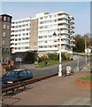
Seabank flats, Penarth
Seabank is a multi-storey building of about 50 flats, at the southern end of Beach Road, near The Esplanade.
Image: © Jaggery
Taken: 24 Nov 2010
0.05 miles


