1
Waitrose, Barry
The Waitrose in Barry is set back 170 metres from the east side
of Palmerston Road, with a large car park in between.
Image: © Jaggery
Taken: 2 Dec 2012
0.01 miles
2
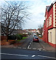
Eastern arm of Cadoc Crescent, Barry
Viewed across Cardiff Road (A4055). The western arm http://www.geograph.org.uk/photo/3248527 of the crescent is about 100 metres away.
Image: © Jaggery
Taken: 2 Dec 2012
0.09 miles
3
Gasholder on the north side of Cardiff Road, Barry
The c40 metre diameter gas holder is located inside a walled compound
between Laura Street and Verlon Close.
Image: © Jaggery
Taken: 2 Dec 2012
0.09 miles
4
Railway line, Palmerston, Barry
A view east from Palmerston Road bridge, along the Vale of Glamorgan railway line.
The next station ahead is Dinas Powys.
Image: © Jaggery
Taken: 2 Dec 2012
0.10 miles
5
Western arm of Cadoc Crescent, Barry
A view north from Cardiff Road (the A4055). The first building on the left side of the road ahead is a former Victorian school, now Palmerston Community Learning Centre. http://www.geograph.org.uk/photo/3248480
The junction of the eastern arm of Cadoc Crescent and Cardiff Road is about 100 metres away. http://www.geograph.org.uk/photo/3248620
Image: © Jaggery
Taken: 2 Dec 2012
0.10 miles
6
Waitrose filling station, Barry
Located in the SW corner of the Waitrose site http://www.geograph.org.uk/photo/3248273 on the east side of Palmerston Road.
Image: © Jaggery
Taken: 2 Dec 2012
0.10 miles
7
An entrance to Palmerston Allotments, Barry
Viewed across Palmerston Road. The allotments occupy a roughly rectangular site,
about 175 metres by 110 metres, on the north side of the Vale of Glamorgan railway line.
Image: © Jaggery
Taken: 2 Dec 2012
0.11 miles
8
Shell filling station, Palmerston Road, Barry
Prices displayed on November 4th 2016 are 117.9 pence per litre
for unleaded petrol, 120.9 pence per litre for diesel.
Image: © Jaggery
Taken: 4 Nov 2016
0.12 miles
9
Bus shelter, Palmerston Road, Palmerstown
Image: © David Smith
Taken: 22 Sep 2022
0.12 miles
10
Ordnance Survey Cut Mark
This OS cut mark can be found on the west parapet of the railway bridge. It marks a point 21.296m above mean sea level.
Image: © Adrian Dust
Taken: 3 Feb 2018
0.13 miles


