1
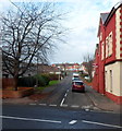
Eastern arm of Cadoc Crescent, Barry
Viewed across Cardiff Road (A4055). The western arm http://www.geograph.org.uk/photo/3248527 of the crescent is about 100 metres away.
Image: © Jaggery
Taken: 2 Dec 2012
0.03 miles
2
Western arm of Cadoc Crescent, Barry
A view north from Cardiff Road (the A4055). The first building on the left side of the road ahead is a former Victorian school, now Palmerston Community Learning Centre. http://www.geograph.org.uk/photo/3248480
The junction of the eastern arm of Cadoc Crescent and Cardiff Road is about 100 metres away. http://www.geograph.org.uk/photo/3248620
Image: © Jaggery
Taken: 2 Dec 2012
0.04 miles
3
Lennox Green, Barry
Viewed across Cardiff Road (the A4055). Lennox Green is an area of 24 flats, arranged in groups of 8 along 3 sides of a rectangle. The western and eastern sides are adjacent to the western and eastern arms of Cadoc Crescent. The northern side (behind the trees) borders James Street.
Lennox Green was named after Dr Mary Lennox who was Barry's first female Medical Officer of Health.
Image: © Jaggery
Taken: 2 Dec 2012
0.05 miles
4
East side of Palmerston Community Learning Centre, Barry
Viewed across Cadoc Crescent. The Centre is located in a former Victorian school.
http://www.geograph.org.uk/photo/3248470 to a view of the opposite side.
Image: © Jaggery
Taken: 2 Dec 2012
0.07 miles
5
Waitrose filling station, Barry
Located in the SW corner of the Waitrose site http://www.geograph.org.uk/photo/3248273 on the east side of Palmerston Road.
Image: © Jaggery
Taken: 2 Dec 2012
0.07 miles
6
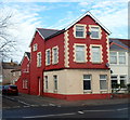
Conspicuous corner house, Cardiff Road, Barry
72 Cardiff Road, on the corner of Cadoc Crescent, is conspicuous both by its colours and by being significantly bigger than neighbouring houses. Perhaps it was formerly a corner shop or pub.
Image: © Jaggery
Taken: 2 Dec 2012
0.07 miles
7
Lennox Green
Here there are 24 flats, surrounding a green rectangle.
Image: © Eirian Evans
Taken: 23 Jun 2021
0.07 miles
8
Palmerston Road semis, Barry
Palmerston Road semi-detached houses viewed from the corner of Arthur Street.
Palmerston Road was named after the Palmer family who formerly owned much land in this area.
Image: © Jaggery
Taken: 4 Nov 2016
0.08 miles
9
West side of Palmerston Community Learning Centre, Barry
The Centre is located in a former Victorian school.
The entrance is from Cadoc Crescent on the opposite side. http://www.geograph.org.uk/photo/3248480
Image: © Jaggery
Taken: 2 Dec 2012
0.08 miles
10
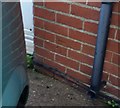
Ordnance Survey Cut Mark
This OS cut mark can be found on No50 Palmerston Road. It marks a point 15.002m above mean sea level.
Image: © Adrian Dust
Taken: 3 Feb 2018
0.08 miles


