1
Winston Road houses, Barry
The houses are in the Merthyr Dyfan area in the north of Barry.
Image: © Jaggery
Taken: 6 Jan 2013
0.05 miles
2
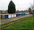
A row of 11 lockup garages, Merthyr Dyfan, Barry
Viewed from Winston Road. The garages can be reached by vehicle
from either Coleridge Crescent or Whitewell Road.
Image: © Jaggery
Taken: 6 Jan 2013
0.05 miles
3
Barry Arts Centre, Colcot, Barry
Barry Arts Centre is the name showing above the door. Engraved in stone below the name is Colcot Welfare Hall.
Image: © Jaggery
Taken: 6 Jan 2013
0.05 miles
4
Colcot One Stop, Barry
The shop at 1-3 Winston Road, Colcot in the north of Barry was formerly a Spar shop.
One Stop convenience store opened here in December 2012.
Image: © Jaggery
Taken: 6 Jan 2013
0.07 miles
5
SW end of Whitewell Road, Barry
Viewed from the Colcot Road end. Whitewell Road is in the Merthyr Dyfan area in the north of Barry.
Image: © Jaggery
Taken: 6 Jan 2013
0.08 miles
6
Two Winston Road shops, Colcot, Barry
Jennies Creations, barber shop and hair & beauty salon is next door to G9 Fish Bar (Chinese meals
to take away). A One Stop convenience store is on the right. http://www.geograph.org.uk/photo/3286172
Image: © Jaggery
Taken: 6 Jan 2013
0.08 miles
7
St David's Methodist Church, Barry
On the corner of Winston Road and Colcot Road. The first Methodist place of worship in the area was a Mission run at a war army camp in 1914. Later, a Sunday school was set up in a house to serve the Colcot area of Barry, followed by a building fondly referred to as a tin shack. The present church's foundation stone was laid on July 24th 1965.
Image: © Jaggery
Taken: 6 Jan 2013
0.10 miles
8
Two semis and two detached houses, Winston Road, Barry
The houses are near the corner of Coleridge Crescent, ahead.
Image: © Jaggery
Taken: 6 Jan 2013
0.10 miles
9
St David's Methodist Church, Colcot Rd, Barry
Image: © John Lord
Taken: 23 May 2010
0.11 miles
10
The Colcot Arms, Colcot Rd, Barry
Image: © John Lord
Taken: 23 May 2010
0.13 miles


