St David's Methodist Church, Barry
Introduction
The photograph on this page of St David's Methodist Church, Barry by Jaggery as part of the Geograph project.
The Geograph project started in 2005 with the aim of publishing, organising and preserving representative images for every square kilometre of Great Britain, Ireland and the Isle of Man.

There are currently over 7.5m images from over 14,400 individuals and you can help contribute to the project by visiting https://www.geograph.org.uk
St David's Methodist Church, Barry
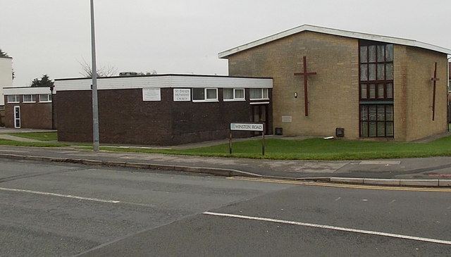
Image: © Jaggery Taken: 6 Jan 2013
On the corner of Winston Road and Colcot Road. The first Methodist place of worship in the area was a Mission run at a war army camp in 1914. Later, a Sunday school was set up in a house to serve the Colcot area of Barry, followed by a building fondly referred to as a tin shack. The present church's foundation stone was laid on July 24th 1965.
Images are licensed for reuse under creativecommons.org/licenses/by-sa/2.0
Image Location
Latitude
51.416777
Longitude
-3.28195