
IMAGES TAKEN NEAR TO
Pleasant View, BARRY, CF62 9QA
Introduction
This page details the photographs taken nearby to Pleasant View, CF62 9QA by members of the Geograph project.
The Geograph project started in 2005 with the aim of publishing, organising and preserving representative images for every square kilometre of Great Britain, Ireland and the Isle of Man.

There are currently over 7.5m images from over14,400 individuals and you can help contribute to the project by visiting https://www.geograph.org.uk
Image Map
Images are licensed for reuse under creativecommons.org/licenses/by-sa/2.0
Notes
- Clicking on the map will re-center to the selected point.
- The higher the marker number, the further away the image location is from the centre of the postcode.
Image Listing (14 Images Found)
Images are licensed for reuse under creativecommons.org/licenses/by-sa/2.0
Image
Details
Distance
1
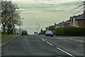
Barry : Port Road East A4050
Heading along Port Road East.
Image: © Lewis Clarke
Taken: 23 Mar 2019
0.08 miles
2
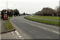
Port Road East, Barry
Port Road East (the A4050) heads NE away from the Colcot area of Barry. The road ahead skirts the Merthyr Dyfan area of Barry.
Image: © Jaggery
Taken: 6 Jan 2013
0.09 miles
3
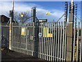
Barry Grid Substation
Secured entrance gates at Grid Substation on Port Road, Barry.
Image: © Alan Hughes
Taken: 18 Nov 2016
0.13 miles

5
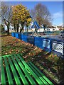
Children's Playground
Children's playground at Meggitt Road, Barry.
Image: © Alan Hughes
Taken: 18 Nov 2016
0.14 miles
6
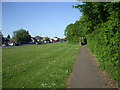
Footpath beside Port Rd East, Barry, the A4050
The rectangular stone structure at the point where the path goes among the bushes is one of a series at irregular intervals along the path. I've no idea what they are for.
Image: © John Lord
Taken: 23 May 2010
0.18 miles
8
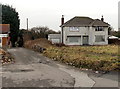
Little Brynhill Lane house and land for sale, Barry
The house is on the corner of Little Brynhill Lane and Port Road East, opposite Brynhill Golf Club. http://www.geograph.org.uk/photo/3285927
The For Sale sign shows "House with 4 acres of development land".
Image: © Jaggery
Taken: 6 Jan 2013
0.19 miles
10
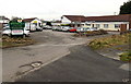
Brynhill Golf Club, Barry
On the corner of Port Road East and Little Brynhill Lane.
Brynhill is an example of tautology. Bryn is Welsh for hill.
Image: © Jaggery
Taken: 6 Jan 2013
0.22 miles