1
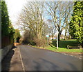
No through road from Maes-y-ffynon, Bonvilston
The road heads north away from houses in Maes-y-ffynon towards Sunnybank and the edge of a golf course.
Image: © Jaggery
Taken: 27 Jan 2012
0.04 miles
2
Thatched house, Bonvilston, Vale of Glamorgan
Image: © John Lord
Taken: 31 Oct 2008
0.05 miles
3
A48 at The Red Lion, Bonvilston
Image: © Colin Pyle
Taken: 1 Aug 2018
0.07 miles
4
The Red Lion, Bonvilston, Vale of Glamorgan
Image: © John Lord
Taken: 31 Oct 2008
0.10 miles
5
Northern end of Maes-y-ffynon, Bonvilston
These houses are near the SW edge of a golf course.
Image: © Jaggery
Taken: 27 Jan 2012
0.10 miles
6
Maes-y-ffynon semis, Bonvilston
Houses in the middle section of Maes-y-ffynon, viewed from the turning into the residential cul-de-sac Village Farm.
Image: © Jaggery
Taken: 27 Jan 2012
0.10 miles
7
Maes-y-ffynon houses, Bonvilston
Located on the north side of the A48, Maes-y-ffynon is a residential street leading to houses in Cottrell Drive and Village Farm.
Image: © Jaggery
Taken: 27 Jan 2012
0.10 miles
8
The Old Barn, Bonvilston
Located on the south side of the A48, the former farm building has been converted for business and residential use.
Image: © Jaggery
Taken: 27 Jan 2012
0.10 miles
9
Number 2 The Old Forge, Bonvilston
One of four houses in a street named The Old Forge on the south side of the A48.
Image: © Jaggery
Taken: 27 Jan 2012
0.10 miles
10
Grade II listed former Village Farm farmhouse, Bonvilston
The thatched cottage on the north side of the A48 dates from the early 18th century, with 19th century alterations. Grade II listed in July 1995.
Image: © Jaggery
Taken: 27 Jan 2012
0.10 miles


