Grade II listed former Village Farm farmhouse, Bonvilston
Introduction
The photograph on this page of Grade II listed former Village Farm farmhouse, Bonvilston by Jaggery as part of the Geograph project.
The Geograph project started in 2005 with the aim of publishing, organising and preserving representative images for every square kilometre of Great Britain, Ireland and the Isle of Man.

There are currently over 7.5m images from over 14,400 individuals and you can help contribute to the project by visiting https://www.geograph.org.uk
Grade II listed former Village Farm farmhouse, Bonvilston
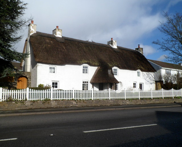
Image: © Jaggery Taken: 27 Jan 2012
The thatched cottage on the north side of the A48 dates from the early 18th century, with 19th century alterations. Grade II listed in July 1995.
Images are licensed for reuse under creativecommons.org/licenses/by-sa/2.0
Image Location
Latitude
51.457262
Longitude
-3.344257