1
Spar shop in Radyr Filling Station, Llantrisant Road, Cardiff
Behind the Esso filling station here. https://www.geograph.org.uk/photo/5662435
Image: © Jaggery
Taken: 26 Jan 2018
0.07 miles
2
Radyr Filling Station, Llantrisant Road, Cardiff
An Esso filling station and Spar shop viewed across the A4119 Llantrisant Road in January 2018.
A Gulf filling station https://www.geograph.org.uk/photo/4373867 was here in March 2015.
Image: © Jaggery
Taken: 26 Jan 2018
0.08 miles
3
Radyr Filling Station, Cardiff
Gulf fuel station and small shop, viewed across Llantrisant Road.
Image: © Jaggery
Taken: 5 Mar 2015
0.09 miles
4
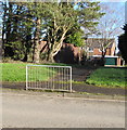
Path to Heol Aradur, Cardiff
From the A4119 Llantrisant Road to houses in the road named Heol Aradur.
Image: © Jaggery
Taken: 26 Jan 2018
0.10 miles
5
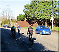
Friday cyclists on Llantrisant Road, Radyr, Cardiff
Travelling north on the A4119 Llantrisant Road on a sunny Friday in late January 2018.
Image: © Jaggery
Taken: 26 Jan 2018
0.10 miles
6
Danescourt and Pentrebane junctions ahead, Radyr, Cardiff
The sign is alongside Llantrisant Road, near a path https://www.geograph.org.uk/photo/5662459 to Heol Aradur.
Image: © Jaggery
Taken: 5 Mar 2015
0.11 miles
7
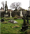
NW corner of the churchyard, Danescourt, Cardiff
Near the lychgate entrance to St John the Baptist church. http://www.geograph.org.uk/photo/4379729
The large monument on the left is for the Fisher family, 19th century residents of Radyr,
many decades before the nearby Danescourt estate was built in the 1970s.
Image: © Jaggery
Taken: 5 Mar 2015
0.15 miles
8
Timothy Rees Close, Danescourt, Cardiff
Viewed across Danescourt Way. The large street name sign lists the many streets (all cul-de-sacs) ahead.
The 20 mph speed limit past a school increases to 30 mph along Timothy Rees Close.
Image: © Jaggery
Taken: 5 Mar 2015
0.15 miles
9
Heol Aradur, Cardiff
Viewed from the Danescourt Way end of Heol Aradur. There is not meant to be a route for vehicles across the grass to or from Danescourt Way, but tyre marks on the grass http://www.geograph.org.uk/photo/4374057 are evidence of at least one recent vehicle passing this way.
Image: © Jaggery
Taken: 5 Mar 2015
0.15 miles
10
Peckham Close
1990s houses in Danescourt.
Image: © Burgess Von Thunen
Taken: 25 Jan 2012
0.16 miles


