NW corner of the churchyard, Danescourt, Cardiff
Introduction
The photograph on this page of NW corner of the churchyard, Danescourt, Cardiff by Jaggery as part of the Geograph project.
The Geograph project started in 2005 with the aim of publishing, organising and preserving representative images for every square kilometre of Great Britain, Ireland and the Isle of Man.

There are currently over 7.5m images from over 14,400 individuals and you can help contribute to the project by visiting https://www.geograph.org.uk
NW corner of the churchyard, Danescourt, Cardiff
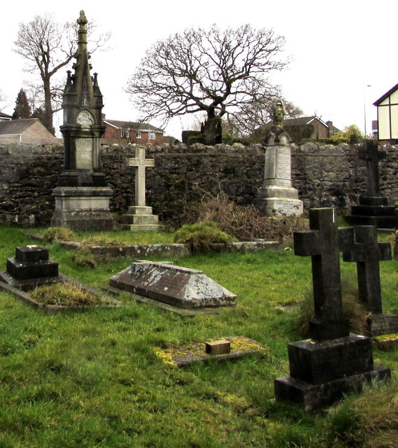
Image: © Jaggery Taken: 5 Mar 2015
Near the lychgate entrance to St John the Baptist church. http://www.geograph.org.uk/photo/4379729 The large monument on the left is for the Fisher family, 19th century residents of Radyr, many decades before the nearby Danescourt estate was built in the 1970s.
Images are licensed for reuse under creativecommons.org/licenses/by-sa/2.0
Image Location
Latitude
51.503885
Longitude
-3.242466