
IMAGES TAKEN NEAR TO
Jevan Close, CARDIFF, CF5 2RF
Introduction
This page details the photographs taken nearby to Jevan Close, CF5 2RF by members of the Geograph project.
The Geograph project started in 2005 with the aim of publishing, organising and preserving representative images for every square kilometre of Great Britain, Ireland and the Isle of Man.

There are currently over 7.5m images from over14,400 individuals and you can help contribute to the project by visiting https://www.geograph.org.uk
Image Map
Images are licensed for reuse under creativecommons.org/licenses/by-sa/2.0
Notes
- Clicking on the map will re-center to the selected point.
- The higher the marker number, the further away the image location is from the centre of the postcode.
Image Listing (57 Images Found)
Images are licensed for reuse under creativecommons.org/licenses/by-sa/2.0
Image
Details
Distance
1
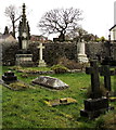
NW corner of the churchyard, Danescourt, Cardiff
Near the lychgate entrance to St John the Baptist church. http://www.geograph.org.uk/photo/4379729
The large monument on the left is for the Fisher family, 19th century residents of Radyr,
many decades before the nearby Danescourt estate was built in the 1970s.
Image: © Jaggery
Taken: 5 Mar 2015
0.07 miles
2
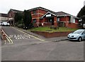
Danescourt Surgery and Danescourt Pharmacy, Cardiff
Viewed across Rachel Close. Pharmacy on the right, surgery on the left.
Image: © Jaggery
Taken: 5 Mar 2015
0.09 miles
3
Path to Heol Aradur, Cardiff
From the A4119 Llantrisant Road to houses in the road named Heol Aradur.
Image: © Jaggery
Taken: 26 Jan 2018
0.09 miles
4
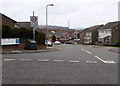
Timothy Rees Close, Danescourt, Cardiff
Viewed across Danescourt Way. The large street name sign lists the many streets (all cul-de-sacs) ahead.
The 20 mph speed limit past a school increases to 30 mph along Timothy Rees Close.
Image: © Jaggery
Taken: 5 Mar 2015
0.09 miles
5

St John the Baptist church, Danescourt, Cardiff
Part of the Parish of Radyr in the Church in Wales Diocese of Llandaff. The church is of medieval origin, probably 14th century. It was extensively altered in the mid 19th century. Grade II listed in 1975.
Image: © Jaggery
Taken: 5 Mar 2015
0.10 miles
6
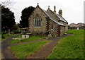
East side of St John the Baptist church, Danescourt, Cardiff
Part of the Parish of Radyr in the Church in Wales Diocese of Llandaff. The church is of medieval origin, probably 14th century. It was extensively altered in the mid 19th century. Grade II listed in 1975.
Image: © Jaggery
Taken: 5 Mar 2015
0.10 miles
7
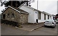
St John's Church Parish Hall, Danescourt, Cardiff
Located in Rachel Close, near the church of St John the Baptist. http://www.geograph.org.uk/photo/4379557
The hall is available for hire by organisations or individuals, for regular activities or one-off. The main activity area provides space suitable for children's activities, personal development activities, family functions and meetings. The hall is also the local electoral polling station for Danescourt.
Image: © Jaggery
Taken: 5 Mar 2015
0.11 miles
8
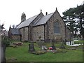
Church of St John the Baptist, parish of Radyr, Cardiff
The church is in the old parish of Radyr, but is now surrounded by the Danescourt housing estate.
Image: © John Lord
Taken: 4 Feb 2009
0.11 miles
9
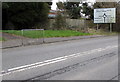
Danescourt and Pentrebane junctions ahead, Radyr, Cardiff
The sign is alongside Llantrisant Road, near a path https://www.geograph.org.uk/photo/5662459 to Heol Aradur.
Image: © Jaggery
Taken: 5 Mar 2015
0.11 miles
10
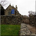
Eastern entrance to St John the Baptist church, Danescourt, Cardiff
From Rachel Close. The church http://www.geograph.org.uk/photo/4379557 is part of the Parish of Radyr in the Church in Wales Diocese of Llandaff.
Image: © Jaggery
Taken: 5 Mar 2015
0.11 miles