IMAGES TAKEN NEAR TO
Heol Isaf, TREHARRIS, CF46 6NS

Introduction

This page details the photographs taken nearby to Heol Isaf, CF46 6NS by members of the Geograph project.

The Geograph project started in 2005 with the aim of publishing, organising and preserving representative images for every square kilometre of Great Britain, Ireland and the Isle of Man.

There are currently over 7.5m images from over14,400 individuals and you can help contribute to the project by visiting https://www.geograph.org.uk

Image Map


Images are licensed for reuse under creativecommons.org/licenses/by-sa/2.0
Notes
  • Clicking on the map will re-center to the selected point.
  • The higher the marker number, the further away the image location is from the centre of the postcode.

Image Listing (64 Images Found)

Images are licensed for reuse under creativecommons.org/licenses/by-sa/2.0
  • ...
Image
Details
Distance
1
Heol Isaf bungalows, Nelson
Viewed from the corner of Heol Fawr.
Image: © Jaggery Taken: 17 Mar 2011
0.07 miles
2
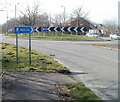
Nelson this way
A sign near the A472 roundabout at the SE edge of Nelson directs pedestrians. Nelson is a village (population about 4,500) in Caerphilly County Borough.
Image: © Jaggery Taken: 17 Mar 2011
0.08 miles
3
A472 NE from Heol Fawr, Nelson
View from Heol Fawr bridge. The sign indicates ahead at the roundabout for Ystrad Mynach, left for Nelson.
Image: © Jaggery Taken: 17 Mar 2011
0.08 miles
4
Ordnance Survey Cut Mark
This OS cut mark can be found on the wall of The Hollies, Heol Fawr. It marks a point 176.577m above mean sea level.
Image: © Adrian Dust Taken: 25 May 2019
0.09 miles
5
Ty Du Road meets Heol Fawr, Nelson
The road here is part of the Rhymney Valley Ridgeway Walk which turns right on to Heol Fawr.
Image: © M J Roscoe Taken: 24 Mar 2018
0.09 miles
6
Road towards Nelson
Image: © John Light Taken: 22 Aug 2013
0.10 miles
7
Heol Fawr
Cyffordd dwy heol: Heol Ty Du a Heol Fawr. A road junction at Heol Ty Dy (trans. black house road) and Heol Fawr (trans. big road)
Image: © Alan Richards Taken: 14 Aug 2016
0.10 miles
8
Bethel Evangelical Church, Nelson, from the south
The church http://www.geograph.org.uk/photo/2318456 and part of the small graveyard viewed across Heol Fawr.
Image: © Jaggery Taken: 17 Mar 2011
0.11 miles
9
Corner of Heol Fawr and Heol Isaf, Nelson
Postbox and yellow road gritting box are alongside the Heol Isaf name sign.
Image: © Jaggery Taken: 17 Mar 2011
0.12 miles
10
Ordnance Survey Cut Mark
This OS cut mark can be found on the SW face of the Ebenezer Chapel. It marks a point 165.141m above mean sea level.
Image: © Adrian Dust Taken: 20 Jul 2018
0.12 miles
  • ...