
IMAGES TAKEN NEAR TO
Park Street, MOUNTAIN ASH, CF45 4PF
Introduction
This page details the photographs taken nearby to Park Street, CF45 4PF by members of the Geograph project.
The Geograph project started in 2005 with the aim of publishing, organising and preserving representative images for every square kilometre of Great Britain, Ireland and the Isle of Man.

There are currently over 7.5m images from over14,400 individuals and you can help contribute to the project by visiting https://www.geograph.org.uk
Image Map
Images are licensed for reuse under creativecommons.org/licenses/by-sa/2.0
Notes
- Clicking on the map will re-center to the selected point.
- The higher the marker number, the further away the image location is from the centre of the postcode.
Image Listing (82 Images Found)
Images are licensed for reuse under creativecommons.org/licenses/by-sa/2.0
Image
Details
Distance
1

Ordnance Survey Cut Mark
This OS cut mark can be found on No47 Aberdare Road. It marks a point 113.206m above mean sea level.
Image: © Adrian Dust
Taken: 27 May 2019
0.05 miles
4

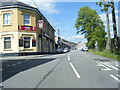
Taff Trail following bend in River Taff near Abercynon
Image: © David Smith
Taken: 17 Sep 2022
0.09 miles
5
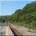
A green view SW from Abercynon railway station
The railway line uses the relatively flat land in the valley of the River Taff. This line is normally used for arrivals from the south. The signal in the distance showing red means that the line can be used for reverse working in special circumstances.
Image: © Jaggery
Taken: 10 Aug 2012
0.10 miles
6
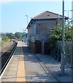
Disused signalbox viewed from the SW, Abercynon
Viewed along the platform used for arrivals from the south and departures to the north, along either the Aberdare line or the Merthyr Tydfil line. The signalbox http://www.geograph.org.uk/photo/3076359 was in use until 2008, when it was replaced by the newly-built signalling centre. http://www.geograph.org.uk/photo/3076373
Image: © Jaggery
Taken: 10 Aug 2012
0.10 miles
7
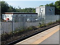
Abercynon Signalling Centre
Opened in 2008, the centre controls the railway signals and points in the area adjacent to Abercynon railway station, from where this view was taken. The signalling centre replaced a wood and brick signalbox http://www.geograph.org.uk/photo/3076359 located on a station platform.
Image: © Jaggery
Taken: 10 Aug 2012
0.10 miles
8
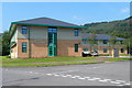
Enterprise House, Navigation Park, Abercynon
Enterprise House (Ty Antur in Welsh) is one of several recently-built offices in Navigation Park.
Image: © Jaggery
Taken: 10 Aug 2012
0.12 miles
9
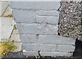
Ordnance Survey Cut Mark
This damaged OS cut mark can be found on No44 Cardiff Street. It marks a point 97.935m above mean sea level.
Image: © Adrian Dust
Taken: 27 May 2019
0.12 miles
10
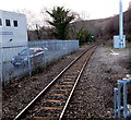
Railway southwest from Abercynon railway station
Viewed from platform 1. Next station ahead is Pontypridd on the route to Cardiff.
Abercynon Signalling Centre http://www.geograph.org.uk/photo/3076373 is on the left.
The base of this http://www.geograph.org.uk/photo/5329569 telecoms mast is on the right.
Image: © Jaggery
Taken: 30 Jan 2016
0.12 miles