
IMAGES TAKEN NEAR TO
Pen-yr-Heol, ABERDARE, CF44 9EA
Introduction
This page details the photographs taken nearby to Pen-yr-Heol, CF44 9EA by members of the Geograph project.
The Geograph project started in 2005 with the aim of publishing, organising and preserving representative images for every square kilometre of Great Britain, Ireland and the Isle of Man.

There are currently over 7.5m images from over14,400 individuals and you can help contribute to the project by visiting https://www.geograph.org.uk
Image Map
Images are licensed for reuse under creativecommons.org/licenses/by-sa/2.0
Notes
- Clicking on the map will re-center to the selected point.
- The higher the marker number, the further away the image location is from the centre of the postcode.
Image Listing (48 Images Found)
Images are licensed for reuse under creativecommons.org/licenses/by-sa/2.0
Image
Details
Distance
1
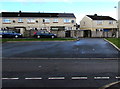
Dan-yr-Heol houses in Penywaun
Opposite Penywaun Primary School. http://www.geograph.org.uk/photo/4338694
Image: © Jaggery
Taken: 31 Jan 2015
0.05 miles
2
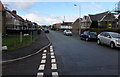
Coedglas, Penywaun
Viewed from the corner of Awelfryn.
Image: © Jaggery
Taken: 31 Jan 2015
0.06 miles
3
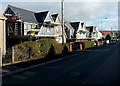
Scaffolding on Coedglas houses in Penywaun
Some of many houses undergoing external work in Penywaun at the end of January 2015.
Image: © Jaggery
Taken: 31 Jan 2015
0.06 miles
4
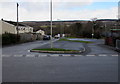
Dan-yr-Heol, Penywaun
The SE end of the street named Dan-yr-Heol, opposite the northern end of Gwladys Street and Awelfryn.
Image: © Jaggery
Taken: 31 Jan 2015
0.06 miles
5
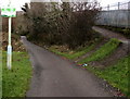
No fly tipping sign alongside a path to the Afon Cynon, Penywaun
Despite the penalties for fly tipping shown on the sign (up to a £50,000 fine or imprisonment, or both)
the riverside area ahead is blighted with rubbish.
Image: © Jaggery
Taken: 31 Jan 2015
0.07 miles
6
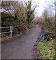
Riverside route from Penywaun to Hirwaun
Footpath and cycleway on the south bank of the Afon Cynon.
A nearby sign shows 1½ miles to Hirwaun, 7 to Glynneath.
Image: © Jaggery
Taken: 31 Jan 2015
0.07 miles
7
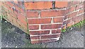
Ordnance Survey Cut Mark
This OS cut mark can be found on the wall of No13 Coedglas. It marks a point 179.061m above mean sea level.
Image: © Adrian Dust
Taken: 26 Feb 2021
0.07 miles
8
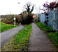
Path junction in Penywaun
The path on the left descends towards a river, Afon Cynon.
The path on the right leads to houses in Brodawel and Erw Las.
Image: © Jaggery
Taken: 31 Jan 2015
0.07 miles
9
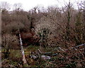
Steps down to a river pipe bridge, Penywaun
Viewed from the footpath and cycleway to Hirwaun on the south bank of the Afon Cynon.
Image: © Jaggery
Taken: 31 Jan 2015
0.07 miles
10
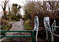
Up towards the village, Penywaun
Viewed from the barrier http://www.geograph.org.uk/photo/4338782 alongside a riverside footpath and cycleway at the northern edge of Penywaun. The road ascends towards houses in the street named Dan-yr-Heol.
Image: © Jaggery
Taken: 31 Jan 2015
0.08 miles