1
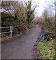
Riverside route from Penywaun to Hirwaun
Footpath and cycleway on the south bank of the Afon Cynon.
A nearby sign shows 1½ miles to Hirwaun, 7 to Glynneath.
Image: © Jaggery
Taken: 31 Jan 2015
0.04 miles
2
Dan-yr-Heol houses in Penywaun
Opposite Penywaun Primary School. http://www.geograph.org.uk/photo/4338694
Image: © Jaggery
Taken: 31 Jan 2015
0.05 miles
3
Up towards the village, Penywaun
Viewed from the barrier http://www.geograph.org.uk/photo/4338782 alongside a riverside footpath and cycleway at the northern edge of Penywaun. The road ascends towards houses in the street named Dan-yr-Heol.
Image: © Jaggery
Taken: 31 Jan 2015
0.06 miles
4
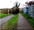
Path junction in Penywaun
The path on the left descends towards a river, Afon Cynon.
The path on the right leads to houses in Brodawel and Erw Las.
Image: © Jaggery
Taken: 31 Jan 2015
0.06 miles
5
No fly tipping sign alongside a path to the Afon Cynon, Penywaun
Despite the penalties for fly tipping shown on the sign (up to a £50,000 fine or imprisonment, or both)
the riverside area ahead is blighted with rubbish.
Image: © Jaggery
Taken: 31 Jan 2015
0.06 miles
6
Dan-yr-Heol, Penywaun
The SE end of the street named Dan-yr-Heol, opposite the northern end of Gwladys Street and Awelfryn.
Image: © Jaggery
Taken: 31 Jan 2015
0.06 miles
7
Steps down to a river pipe bridge, Penywaun
Viewed from the footpath and cycleway to Hirwaun on the south bank of the Afon Cynon.
Image: © Jaggery
Taken: 31 Jan 2015
0.06 miles
8
Boulders and barrier at the edge of a riverside cycle route, Penywaun
There is nothing behind the camera to prevent a car or other unsuitable vehicle getting this far, so boulders
and a metal barrier prevent misuse of the path and cycle route ahead, along the south bank of the Afon Cynon. The signpost in the background shows National Cycle Network routes 46 and 478. The arm pointing left shows 1½ (miles) to Hirwaun, 7 to Glynneath. The details on the right-pointing arm have been partly damaged.
Image: © Jaggery
Taken: 31 Jan 2015
0.07 miles
9
Public footpath towards the river, Penywaun
A public footpath sign on the left points along this route down to the Afon Cynon.
Image: © Jaggery
Taken: 31 Jan 2015
0.07 miles
10
Ordnance Survey Cut Mark
This OS cut mark can be found on the wall of No13 Coedglas. It marks a point 179.061m above mean sea level.
Image: © Adrian Dust
Taken: 26 Feb 2021
0.08 miles


