1
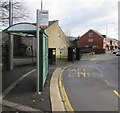
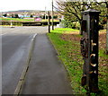
Cemetery Road bus stop and shelter, Trecynon, Aberdare
This stop for buses to Aberdare town centre and bus station is on the north side of the B4275 Cemetery Road near the corner of Potters Field. The bus stop sign shows Aberdare College which is about 200 metres behind the camera.
Image: © Jaggery
Taken: 11 Feb 2019
0.03 miles
2
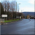
Cemetery Road towards Aberdare town centre
The sign pointing right along the B4275 Cemetery Road shows 1 mile to Aberdare town centre, 23 to Cardiff.
Image: © Jaggery
Taken: 31 Jan 2015
0.04 miles
3
Burger Express, 46 Cemetery Road, Trecynon, Aberdare
Viewed across the B4275 Cemetery Road in February 2019.
The name on the premises in a June 2011 Google Street View was Baguette Express.
Image: © Jaggery
Taken: 11 Feb 2019
0.05 miles
4
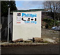
Phillips Monumental Sculptors direction sign, Aberdare
The turquoise arrow on the sign on Phillips Monumental Sculptors former premises points right towards their current premises in Park Monumental Works, Hirwaun Road, Trecynon.
Image: © Jaggery
Taken: 11 Feb 2019
0.05 miles
5
Level crossing gate support
This old structure is located where Cemetery Road crossed the railway branch line from Hirwaun to Cwm Dare.
Image: © Alan Hughes
Taken: 23 May 2019
0.07 miles
6
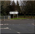
B4275 distance and direction signs facing the Cwmdare Road junction, Aberdare
Left along the B4275 Hirwaun Road for Penywaun (1 mile) and Hirwaun (2½)
Right along the B4275 Cemetery Road for Aberdare town centre (1 mile).
Also turn right here for Cardiff (23 miles).
Image: © Jaggery
Taken: 11 Feb 2019
0.08 miles
7
Old metal structures on the north side of Cemetery Road, Aberdare
Viewed in February 2019. The metal structure is near another one in the background in front of a wooden pole. Station Place houses https://www.geograph.org.uk/photo/4331281 are nearby, so these structures may have been level crossing gate supports.
Image: © Jaggery
Taken: 11 Feb 2019
0.08 miles
8
Y Dolydd, Aberdare
Y Dolydd is a cul-de-sac of recently-built houses on the SE side of Cwmdare Road viewed in February 2019.
Image: © Jaggery
Taken: 11 Feb 2019
0.09 miles
9
Wales & West Utilities gas installation, Cwmdare Road, Cwmdare
The green gas installation is inside a green fence at the bottom of Cwmdare Road, near the Hirwaun Road and Cemetery Road junction.
Image: © Jaggery
Taken: 31 Jan 2015
0.10 miles
10
Entrance to Aberdare High School
From Cwmdare Road. This site also contains Dare Community Sports Hall.
Image: © Jaggery
Taken: 31 Jan 2015
0.10 miles


