1
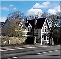
Cwm Boi flows towards Aberdare Road, Fernhill
The stream Cwm Boi is a tributary of the Afon Cynon.
Viewed from the south side of Aberdare Road.
Image: © Jaggery
Taken: 22 Feb 2014
0.05 miles
2
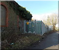
Eastern boundary of Abercwmboi
Viewed along the B4275. Abercwmboi is a village between Mountain Ash and Aberdare.
Image: © Jaggery
Taken: 22 Feb 2014
0.05 miles
3
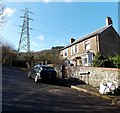
Aberdare/Mountain Ash boundary marker
Viewed across the B4275 Aberdare Road. On the left, a small marker on the wall shows Aberdare on its left side and Mountain Ash on its right. The physical boundary here is a stream named Cwm Boi. http://www.geograph.org.uk/photo/3857565
Image: © Jaggery
Taken: 22 Feb 2014
0.05 miles
4
Drainage channel, Abercwmboi
Alongside an unnamed road between the B4275 Bronallt Terrace and a former colliery building. http://www.geograph.org.uk/photo/3859701
Image: © Jaggery
Taken: 22 Feb 2014
0.08 miles
5
Abercwmboi Switching Site
Located at the edge of a disused colliery building. http://www.geograph.org.uk/photo/3859701 The identifier on the Western Power Distribution electricity substation is Abercwmboi Switching Site S/S No. 55-3336.
Image: © Jaggery
Taken: 22 Feb 2014
0.08 miles
6
Former colliery building in Abercwmboi
Located between the B4275 Bronallt Terrace and Blaencwmboi Villas. http://www.geograph.org.uk/photo/3859680
A sign points right towards Pit Cottage past an electricity substation.
Image: © Jaggery
Taken: 22 Feb 2014
0.09 miles
7
Pit Cottage, Abercwmboi
The winding wheel on the left was part of the colliery formerly on this site.
Image: © Jaggery
Taken: 22 Feb 2014
0.10 miles
8
Drain enters a culvert under Bronallt Terrace, Abercwmboi
It looked like a stream to me, but maps show it as a drain,
one of several channels draining a hillside that used to be the site of a colliery.
Image: © Jaggery
Taken: 22 Feb 2014
0.10 miles
9
Blaencwmboi Villas, Abercwmboi
Set back from, and 150 metres south of, the B4275 Bronallt Terrace near the site of a former colliery.
Image: © Jaggery
Taken: 22 Feb 2014
0.11 miles
10
Lane above Blaencwmboi Villas, Abercwmboi
The lane ascends away from these http://www.geograph.org.uk/photo/3859680 houses.
Image: © Jaggery
Taken: 22 Feb 2014
0.15 miles


