
IMAGES TAKEN NEAR TO
Maerdy, FERNDALE, CF43 4AL
Introduction
This page details the photographs taken nearby to CF43 4AL by members of the Geograph project.
The Geograph project started in 2005 with the aim of publishing, organising and preserving representative images for every square kilometre of Great Britain, Ireland and the Isle of Man.

There are currently over 7.5m images from over14,400 individuals and you can help contribute to the project by visiting https://www.geograph.org.uk
Image Map
Images are licensed for reuse under creativecommons.org/licenses/by-sa/2.0
Notes
- Clicking on the map will re-center to the selected point.
- The higher the marker number, the further away the image location is from the centre of the postcode.
Image Listing (17 Images Found)
Images are licensed for reuse under creativecommons.org/licenses/by-sa/2.0
Image
Details
Distance
1
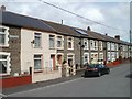
Blake Street, Maerdy
Blake Street follows an inverted-L course on the north side of Maerdy Road (A4233). This view is from the angle of the L, look along houses furthest away from Maerdy Road.
Image: © Jaggery
Taken: 11 May 2011
0.03 miles
2
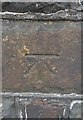
Ordnance Survey Cut Mark
This OS cut mark can be found on the wall SW side of Maerdy Road. It marks a point 296.253m above mean sea level.
Image: © Adrian Dust
Taken: 16 Jun 2017
0.04 miles
3
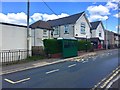
Bus stop
Bus stop outside the Maerdy Conservative Workingmen’s Club.
Image: © Alan Hughes
Taken: 4 May 2019
0.05 miles
4
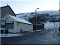
Heol Alfred
Takeaway at junction with Richard Street.
Image: © Colin Pyle
Taken: 4 Jan 2010
0.06 miles
5
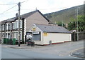
Ty's fish and chip shop, Maerdy
Located at 50 Richard Street (A4233) and Heol Alfred.
Image: © Jaggery
Taken: 11 May 2011
0.07 miles
6
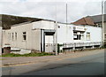
Maerdy Ex-Servicemen's Club
Located on Richard St (A4233), next door to the Conservative club, http://www.geograph.org.uk/photo/2412846 and facing Ty's fish and chip shop. http://www.geograph.org.uk/photo/2412736
Image: © Jaggery
Taken: 11 May 2011
0.07 miles
7
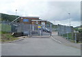
Entrance to Maerdy Junior School
The entrance is at the SE side of the school. Vehicles reach the school from the A4233 along a looping road, Heol Alfred, which bends through 270 degrees. Pedestrians have the alternative of a shorter, steeper route up steps http://www.geograph.org.uk/photo/2412877
Image: © Jaggery
Taken: 11 May 2011
0.07 miles
8
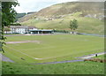
Football ground, Maerdy
Viewed from the edge of Blake Street. The entrance to the ground is on the far side, from Brook Street.
Image: © Jaggery
Taken: 11 May 2011
0.07 miles
9
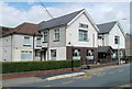
Maerdy Conservative Workingmen's Club
Located on Richard Street (A4233), next door to Maerdy Ex-Servicemen's Club. http://www.geograph.org.uk/photo/2412839
Image: © Jaggery
Taken: 11 May 2011
0.07 miles
10
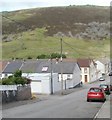
Brook Street, Maerdy
Houses on the NW side of Brook Street viewed from the Maerdy Road side. The left turn at the house with the brown door is into Oxford Street.
Image: © Jaggery
Taken: 11 May 2011
0.11 miles