IMAGES TAKEN NEAR TO
Penrhys Uchaf, FERNDALE, CF43 3BA

Introduction

This page details the photographs taken nearby to Penrhys Uchaf, CF43 3BA by members of the Geograph project.

The Geograph project started in 2005 with the aim of publishing, organising and preserving representative images for every square kilometre of Great Britain, Ireland and the Isle of Man.

There are currently over 7.5m images from over14,400 individuals and you can help contribute to the project by visiting https://www.geograph.org.uk

Image Map


Images are licensed for reuse under creativecommons.org/licenses/by-sa/2.0
Notes
  • Clicking on the map will re-center to the selected point.
  • The higher the marker number, the further away the image location is from the centre of the postcode.

Image Listing (40 Images Found)

Images are licensed for reuse under creativecommons.org/licenses/by-sa/2.0
  • ...
Image
Details
Distance
1
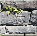
Ordnance Survey Cut Mark
This OS cut mark can be found on the concrete post south side of Penrhys Road. It marks a point 261.619m above mean sea level.
Image: © Adrian Dust Taken: 18 Jun 2017
0.05 miles
2
Dringo tyle / Climbing hill
Cerddwr yn cyrraedd pen uchaf llwybr hir serth. A walker arriving at the top of a long steep hill.
Image: © Alan Richards Taken: 5 Mar 2016
0.05 miles
3
Ordnance Survey Cut Mark
This OS cut mark can be found on the wall south side of Penrhys Road. It marks a point 237.717m above mean sea level.
Image: © Adrian Dust Taken: 24 Jun 2017
0.08 miles
4
Towards Tylorstown from Penrhys
In the county borough of Rhondda Cynon Taf, the B4512 Penrhys Road descends away from Penrhys. Penrhys Cemetery's perimeter wall is on the left.
Image: © Jaggery Taken: 30 Mar 2015
0.09 miles
5
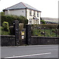
Penrhys Cemetery lodge
The lodge is at the southern edge of the cemetery, viewed across the B4512 Penrhys Road.
Image: © Jaggery Taken: 30 Mar 2015
0.13 miles
6
Ordnance Survey Cut Mark
This damaged OS cut mark can be found on the wall west side of Penrhys Road. It marks a point 219.136m above mean sea level.
Image: © Adrian Dust Taken: 24 Jun 2017
0.15 miles
7
Penrhys Cemetery path fork
Near the cemetery entrance. http://www.geograph.org.uk/photo/4424154
Image: © Jaggery Taken: 30 Mar 2015
0.15 miles
8
SE boundary of Penrhys
The sign is alongside the B4512 Penrhys Road from Tylorstown. Both locations are in the county borough of Rhondda Cynon Taf.
Image: © Jaggery Taken: 30 Mar 2015
0.15 miles
9
Entrance to Penrhys Cemetery
From Heol Pendyrus in the south of the village.
Image: © Jaggery Taken: 30 Mar 2015
0.16 miles
10
Ordnance Survey Cut Mark
This OS cut mark can be found on the wall of the cemetery on Penrhys Road. It marks a point 282.666m above mean sea level.
Image: © Adrian Dust Taken: 18 Jun 2017
0.16 miles
  • ...