1
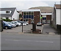
Jobcentre Plus in Treorchy
Located in Oldway House, set back from the east side of the A4061 Bute Street.
The car park is for the vehicles of Jobcentre Plus staff only.
Image: © Jaggery
Taken: 9 Apr 2018
0.01 miles
2
Treorchy Fire Station
Treorchy Fire Station, Bute Street, Treorchy lies up a side road from the main road along the valley through Treorchy
Image: © Kevin Hale
Taken: 5 Jun 2007
0.03 miles
3
SAM Chartered Building Company, Ynyswen
Located in SAM House Ynyswen Road in Ynyswen near the Treorchy boundary.
Image: © Jaggery
Taken: 9 Apr 2018
0.03 miles
4
Ynyswen boundary sign
The sign alongside the A4061 faces Treorchy.
The boundary is marked by the stream Nant Orci https://www.geograph.org.uk/photo/5737709 which flows under the road bridge here.
Image: © Jaggery
Taken: 9 Apr 2018
0.04 miles
5
Treorchy fire station and training tower
Set back about 80 metres from the A4061, Treorchy fire station is located on the bank of a stream, Nant Orci. Part of South Wales Fire and Rescue Service, the station serves the main town of Treorchy and surrounding villages such as Cwmparc, Ynyswen, Treherbert, Tynewydd, Blaenrhondda and Blaencwm, with an estimated total population of 21,000 people. There are 14 retained duty system firefighters and one administrative assistant. The station opened in December 1973.
Image: © Jaggery
Taken: 23 Jan 2012
0.04 miles
6
Ordnance Survey Cut Mark
This OS cut mark can be found on No189 Bute Street. It marks a point 169.091m above mean sea level.
Image: © Adrian Dust
Taken: 28 Apr 2017
0.04 miles
7
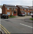
Bute Street houses, Treorchy
Alongside the A4061 Bute Street. The house on the right is near Abergorki Hall. https://www.geograph.org.uk/photo/5737926
Image: © Jaggery
Taken: 14 Mar 2020
0.04 miles
8
Rooftop solar panels, Dunraven Terrace, Ynyswen
Optimally placed on south-facing roofs.
Image: © Jaggery
Taken: 9 Apr 2018
0.05 miles
9
Glyn Rhondda electricity substation, Ynyswen
Located opposite Ainon Welsh Baptist Chapel https://www.geograph.org.uk/photo/2790081 the grey cabinet is a Western Power Distribution
electricity substation. Its identifier is GLYN RHONDDA S/S 542084
Image: © Jaggery
Taken: 9 Apr 2018
0.05 miles
10
Ordnance Survey Rivet
This OS rivet can be found on the wall of the Ainen Chapel. It marks a point 170.216m above mean sea level.
Image: © Adrian Dust
Taken: 28 Apr 2017
0.05 miles


