Treorchy fire station and training tower
Introduction
The photograph on this page of Treorchy fire station and training tower by Jaggery as part of the Geograph project.
The Geograph project started in 2005 with the aim of publishing, organising and preserving representative images for every square kilometre of Great Britain, Ireland and the Isle of Man.

There are currently over 7.5m images from over 14,400 individuals and you can help contribute to the project by visiting https://www.geograph.org.uk
Treorchy fire station and training tower
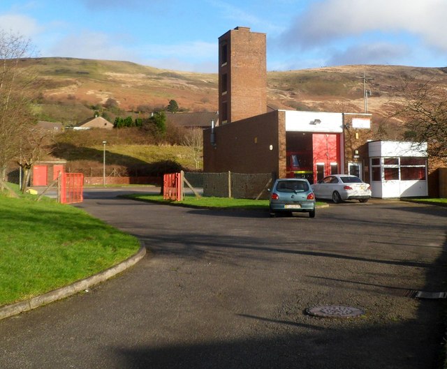
Image: © Jaggery Taken: 23 Jan 2012
Set back about 80 metres from the A4061, Treorchy fire station is located on the bank of a stream, Nant Orci. Part of South Wales Fire and Rescue Service, the station serves the main town of Treorchy and surrounding villages such as Cwmparc, Ynyswen, Treherbert, Tynewydd, Blaenrhondda and Blaencwm, with an estimated total population of 21,000 people. There are 14 retained duty system firefighters and one administrative assistant. The station opened in December 1973.
Images are licensed for reuse under creativecommons.org/licenses/by-sa/2.0
Image Location
Latitude
51.663812
Longitude
-3.51375